Showing posts with label Washington. Show all posts

Friday, May 15, 2020

Chasing Erratics on the Great (Kitsap) Peninsula.

Yesterday I decided to go on a little adventure and investigate some of the known glacial erratics that I had heard of on the Great (Kitsap) Peninsula, specifically in the Illahee Area.

A glacial erratic is a piece of rock that differs from the size and type of native rock in the area on which it rests. They are carried by glacial ice, often hundreds of miles. Erratics can be as small as pebbles or larger than a building.

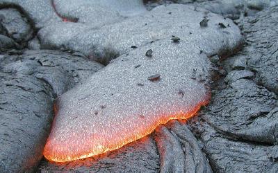
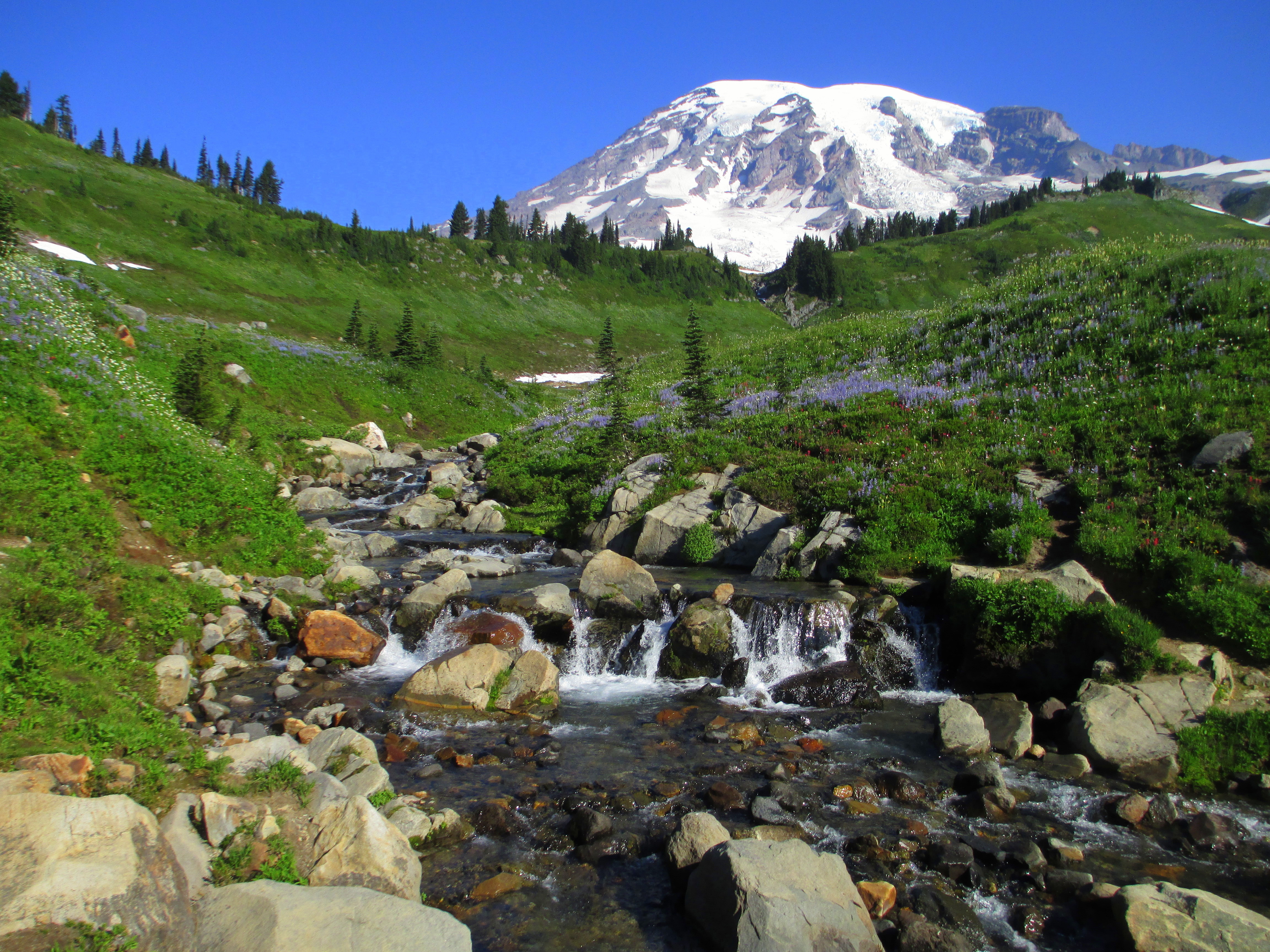
Erratics are common on the Great (Kitsap) Peninsula because this area has been subject to half a dozen or more glaciations over the past 2 million years, with the last one ending 16,000 years ago. During these glaciations, a large tongue of ice known as the Puget Lobe advanced south to fill the Puget Lowland as far as Olympia. Over the Great Peninsula, it was probably well over 2,000 feet thick! More than enough to flow entirely over the top of Green Mountain and the rest of the Blue Hills.

The extent of the Puget Lobe of the Canadian ice sheet. Photo courtesy of Washington DNR. 
Since this glacier came from the north, originating in southern Canada, it was plucking pieces of rocks off the mountains there. The rock types found in the Canadian Rockies and coast ranges are much different than those found here on the Great and Olympic Peninsulas, mostly granites and metamorphic rocks. Our hard bedrock here is either igneous rock of the Blue Hills or sedimentary rock of the Blakeley Formation. So if you see a granitic rock somewhere on the Peninsula, whether it be your yard, a beach, or a park, you can assume it's a glacial erratic.

We likely have hundreds if not thousands of significant glacial erratics on our peninsula. Most of them are probably buried beneath the surface, trapped in the thick glacial formations. This point was illustrated to me quite nicely when I was watching a well being drilled near Central Valley, it encountered a glacial erratic along the way down, and suddenly shards and flakes of beautiful granite came flying out!

However, there are some sizable erratics on the surface that you can find. Yesterday I found 3, which are listed below.

  • Ther is a glacial erratic in the Almira Drive parking lot for the Illahee Preserve in East Bremerton. This is a metamorphic rock showing smooth surfaces probably polished by glacial ice as it was transported. 
The Illahee Erratic, with a telephone pole for scale. 
  • There is a large glacial erratic on the east side of Illahee road just as the road begins to drop towards the coast traveling northbound. This is one of the largest erratics I have seen on the Peninsula. And interestingly. It is not granitic or metamorphic, it appears to be a large chunk of basalt, which means it may have been plucked from the Olympic Mountains.
  • On the corner of Trenton Ave and Fernwood Street, in a lucky person's front yard, is a huge glacial erratic of Blue-Gray volcanic rock suspiciously similar looking to the rocks found in the Blue Hills. Perhaps it was plucked off of Green Mountain or one of the surrounding summits? The best viewing for this erratic is in the pullout on the west side of Trenton Ave, please respect the landowner's property by not attempting to go into their yard. 

These are just a few of the many significant erratics that are scattered around the peninsula, as I stumble across more, if they are substantial enough, I will do a write up for them too. I know there are several in North Kitsap, so perhaps I'll go explore up there sometime in the near future. Summer is just around the corner, and geologic adventures are everywhere in Washington State and the Great Peninsula!

Wednesday, April 1, 2020

Kitsap County Geology: Green Mountain, Gold Mountain, and the Blue Hills.


I'm back. And no foolin'. 

The volcanic plateau of Yellowstone National Park that I call home is closed, set to reopen in the future at some as yet undecided date due to the pandemic sweeping the globe. I'm currently in Kitsap for the time being, socially isolating and eagerly awaiting any news. So during this lull, I got out the technological feather duster and opened this blog up after a...*quick mental math*... two-year absence. My sincerest apologies to devoted readers out there. 

Everyone in Kitsap County knows about Green Mountain, our forested little peak rising to an altitude of 1,710 feet, the second-highest peak on the Kitsap Peninsula. Gold Mountain to the south beats it out by 50 feet, reaching 1,761 feet. Green and Gold Mountains are the two highest summits in a cluster of hills referred to collectively as the Blue Hills. The Blue Hills is an official name accepted by the United States Geologic Survey, I would love for it to become common usage. Wishful thinking? probably, but you heard it here first!

Terrain map of the Blue Hills. on the Kitsap Peninsula. The city of Bremerton lies on the right side of the image. Kitsap Lake in the right-center. 
The Blue Hills emerge like the tip of a rocky iceberg from the center of the Kitsap Peninsula in a sea of glacial deposits. The glacial deposits have their own story, but that's a tale for another time. What are the Blue Hills made out of anyways? 

Components of Igneous Rocks
 (Click image to view full size.)
Chart from the USGS about igneous rocks and their mineral components. Surprisingly, you can find examples of almost every rock on this chart in the Blue Hills. 

The chart above illustrates different igneous rocks and their mineral components. Igneous rocks are rocks formed from magma or lava. If the rock is formed from magma below the surface, it is called an intrusive rock. If the rock is formed above the crust as a result of magma erupting onto the surface as lava, it is an extrusive rock. The Blue Hills are made up of both intrusive and extrusive rocks.

The primary rock composing the Blue Hills is gabbro. Gabbro is a coarse-grained, dark-colored, intrusive igneous rock made up mostly of the minerals plagioclase feldspar and pyroxenes. Gabbro is the intrusive equivalent of the most common extrusive volcanic rock on earth, basalt. Basalt is also present in large quantities in the Blue Hills. Gold Mountain is completely made of basalt, and the large rock outcrops you can see on the north shore of Sinclair Inlet alongside Highway 3 are basalt lava flows. Basalt from the eastern edge of the Blue Hils is mined and used in landscaping and construction purposes. Many of the rock retaining walls you can find around the Kitsap Peninsula were mined from the Blue Hills.

Hot basalt lava flowing over the surface of a cooled basalt lava flow.
 (Click image to view full size.)
A typical basalt lava flow. Photo by USGS. 

Following the emplacement of the gabbro and basalt of what would become the Blue Hills, the whole mass of rock was invaded by a swarm of structures known as dikes. Dikes are tabular or sheet-like bodies that intrude into existing rock units vertically or near vertically. When exposed they can look like narrow vertical cracks filled with volcanic or sedimentary material. Two kinds of rocks form the dikes that riddle the Blue Hills. Some of the dikes are andesite, a volcanic rock made up of mostly plagioclase, similar to basalt, but containing some quartz, which is rarely found in basalt. The other type of rock is dacite, another volcanic rock which has an even higher percentage of quartz than andesite (See chart above).

The final drop of "Gold Creek Cascades" goes over a dike of andesite. 
So, where can you see these rocks? Unfortunately, if there's one thing that Kitsap geology isn't, it's being easy to see. Right square in the center of the Pacific Northwest, our lush vegetation and vibrant growth hides most of the rocks from our sight. I already mentioned the most easily visible outcrop of rock in the county, the cliffs of basalt towering over highway 16 on the north shore of Sinclair Inlet. Aside from that, there are exposures of gabbro and basalt on the way up to the summit of green mountain, with the main viewing area (currently closed as of this writing) being built on the edge of a large basalt cliff. If you know the location of "school rock/turtle rock/eagle rock" on the south flank of Green Mountain, that is composed of gabbro. And there are a couple blink-and-you-miss-it outcrops of rock along the south side of Holly Road as it skirts the base of Peak 1291.

There are other stories to be told about the geology of the Blue Hills that I left out of this post for the purpose of time and the fact that scrolling for long periods is universally hated. I do plan to stay diligent though and see if I can get the flow going on this blog again. I can't promise multiple posts a week. But hopefully, something between 1-5 posts a month is what I'm shooting for. If there's one thing I love more than geology, it's telling other people about geology. And I've learned a LOT since I last worked on this blog. I think it's time to share some of that. Until next time!

Tuesday, January 9, 2018

The Ellensburg Formation: A Distant Cousin to Kitsap's Blakely Formation.

It's been almost a year to the day since I've last posted. I hope to get a flow going again, especially since I'm graduating this March. So here we go.

The Cascade volcanoes have been erupting for 40 million years, constructing massive volcanic edifices, ejecting clouds of debris and ash to rain down on eastern Washington, and sending mudflows and floods careening down river valleys into the Pacific Ocean, Puget Sound, and eastern lowlands. Today with the current position of our five active fire mountains, most, if not all, lahars are directed to the west towards Puget Sound with its densely populated metropolitan centers or south towards the Columbia River. Millions of years ago, the setting was slightly different. A volcano or a group of volcanoes near the present-day location of White Pass were active, violently active. Explosive eruptions blasted frothy gas-rich magma out of their throats and sent moving masses of water, ash, and clay barrelling down ancient river valleys. One of these valleys was aimed at the present-day location of Thorp, Washington.

The Kittitas Valley with its modern-day volcanic sentinels Mount Adams (Left) and Mount Rainier (right). 
Driving east along Interstate 90 past Thorp, one can look across the valley to the north and spot a group of imposing white cliffs towering over the adjacent fields. For a closer look, Highway 10 between Ellensburg and Thorp passes immediately below these cliffs. These are the "White Bluffs," and they are a geologic staple of the Kittitas Valley. These cliffs reveal a stack of 4-5 volcanic lahars produced by the volcanoes near White Pass so many millennia ago. The lahars appear as a solid white mass of ash-rich cement, suspending huge boulders of volcanic rock and peppered with sponge-like pumice, which is typically produced in significantly explosive eruptions. Each lahar is separated by beautifully layered river deposits, organized and sorted beds with crossbeds and other patterns, marking periods of slower processes compared to the catastrophic volcanic apocalypses which ravaged the river valley half a dozen times. 

Outcrop of the "White Bluffs" showing a lahar (Thick layer at the base) and river deposits over the top. 
This outcrop is just a small section of the Ellensburg Formation. This geologic formation can be found throughout the Kittitas and Yakima Valleys and varies significantly throughout its extent. Just southwest of Central Washington University's campus is "Craig's Hill," an elongated knoll in the middle of the city. This hill is almost wholly composed of the Ellensburg Formation. However, it differs in composition from the "White Bluffs" in that there is only one volcanic lahar exposed; the majority of the hill is mostly a series of thick river rock deposits known as conglomerates. 

An exposed cliff face on Craig's Hill in Ellensburg showing it's large gravel deposits. 
The Ellensburg Formation's make up should sound familiar to readers, with its interwoven gravels, sandstones, and mudflows. It is, in fact, similar to the Blakeley Formation, which lies around the shorelines of Puget Sound and similarly records early volcanic activity in the Cascades. These two geologic cousins demonstrate how volcanism has been significantly affecting the state on both sides of the cascades for millions of years, and they will continue to do so for quite some time.


Saturday, July 9, 2016

In the Shadow of a Volcano: Meadow Roving 2016.

Once again, it's been a while. Been up to my eyeballs in schoolwork, family get-togethers, and back to back adventures across the Western United States. But the rest of the summer is looking to be awesome. Why? Because I get to spend it here: 

Edith Creek and Mount Rainier, Paradise. Photo from Wikipedia. 

That's right! I am now an official Meadow Rove Volunteer in Mount Rainier National Park for the entire summer of 2016 and potentially into the future beyond as well!

What the heck does that mean? Well it means that I get to camp in the park for free, and every day I get up, Put on my NPS volunteer uniform, and proceed to hike around the subalpine meadows of Paradise and Sunrise all day; answering questions, teaching people about the park, and maybe most importantly, protecting the sensitive meadows from getting trampled by curious visitors who may not know what damage they are causing.

I will be volunteering in the park from now until August 30 every week from Monday through Thursday, bouncing back and forth between Paradise and Sunrise every week. I just finished my first week at Paradise, and I am looking forward to my first week at Sunrise as well!

If you are planning to visit the park, I am not sure where I will be at Sunrise yet, but at Paradise you can probably find me around Myrtle Falls, Edith Creek, and the Golden Gate Trail. Basically if you're within eyeshot of one of Edith Creek's waterfalls, you're going to be within eyeshot of me (Surprised? you really shouldn't be).

Here's to a wonderful summer of wandering around on Washington's tallest fire mountain!

Monday, December 21, 2015

Kitsap Waterfall Survey: Tin Mine Creek Revisit 12/13/15

The week prior to December 13, the Kitsap Peninsula had enjoyed a thorough and much needed dousing of steady rain. The creeks predictably swelled in response, and I knew exactly where I wanted to go first. It had been nearly eight months since the last time I visited "Tin Mine Falls" back in March, and it was time to go see the survey's largest waterfall again.

Tin Mine Falls 12/13/15
Photo by Micah K.
Hiking up the dampened GM-1 road, it became quickly apparent there was going to be a lot of water in the creek. Every little side gully and low spot had water in it, and the branches were still dripping. 40 minutes after parking the car, My hiking partner and I finally arrived at the creek. When my friend Spencer and I had first discovered Tin Mine in January 2015, it was full of water, crashing through the basalt canyon. I didn't think it would be possible for the creek to get any more filled, but apparently it is; the swollen spectacle that greeted us on December 13 was nothing short of astounding. The creek was absolutely thundering through the canyon. Arriving at the best spot for viewing I like to call "The Overlook" I came face to face with the entire display.

It became readily apparent to me that we weren't going to be able to make it to the bottom of the largest tier, which requires scrambling up and over the lowest tier of the falls. The amount of water made it nearly impossible, if not downright dangerous. So after watching and photographing "Tin Mine Falls" for a few minutes, we moved towards "Echo Falls," and got another shock.

Usually I access "Echo Falls" by rock hopping across the creek about 50 feet upstream of the falls. This is no longer possible. It appears one of the many windstorms that has slammed the peninsula recently caused 3-4 large pine trees to fall into the creek, shattering and creating a natural dam. The creek has pooled up 3-4 feet deep behind this dam, inundating the once perfect crossing, it's now wade across, or cross a log a little bit more upstream.

Once we successfully crossed to the other side, we scrambled down to "Echo Falls". For the first time I have seen, It was completely full. Words can almost not do it justice.

Echo Falls 12/13/15
Photo by Micah K. 


Sunday, November 29, 2015

Kitsap Waterfall Survey: "Kerplunk Falls"

This fall was surveyed a while ago. But I had never written a post about it, so I have decided to fix that.

Lost Creek is one of the largest creeks flowing out of the Blue Hills. It comes down off the eastern slopes of Green Mountain and flows east until it joins with Wildcat Creek to form Chico Creek, which is has one of the best salmon runs on the Kitsap Peninsula. I had long suspected Lost Creek to have a fall somewhere along it's upper reaches, assuming it was a permanent stream. I made the 2 mile hike around Green Mountain to where an old logging road crosses the incipient creek.

Starting upstream, I almost immediately entered into a deep basalt gorge lined with old pillow lava, through which Lost Creek flowed. I scrambled and fought my way up the gorge, becoming rapidly frustrated with the lack of vertically falling water. Finally, probably about 300 or so feet up the canyon, I found a fall, sort of.

"Kerplunk Falls" 
As the creek takes a sharp righthand bend, it has become dammed up with a rather impressive logjam immediately over a small 10 foot basalt ledge. After filtering through the logjam, the creek plunges straight down over the drop, landing in a shallow alcove and continuing along its way. When I first observed this fall, the appearance of the logjam reminded me of the child's game Kerplunk and so I have tentatively named this small waterfall "Kerplunk Falls"

I suspect this canyon has more to offer above "Kerplunk," however at the time of the survey, I was too exhausted to continue further up the canyon, I scrambled up to the rim and began walking back down towards the road. As I walked down the slope along the rim, I noticed numerous signs of bear frequenting the area, A reminder that this is bear country.


Wednesday, November 25, 2015

Kitsap Waterfall Survey: "Contact Cascades"-My 20th waterfall!

Following my lecture at the Norm Dicks Government Building in Bremerton, one of the audience members came to me and told me of a waterfall on the Beaver Pond Trail within the Green Mountain State Forest. Their description seemed to indicate something small, but they insisted it was over bedrock, and so I decided to investigate.

As the wind howled through the trees and branches of various sizes fell all around, I hiked up the side of Green Mountain until I reached the Beaver Pond Trail. Within a few hundred feet, the trail crosses over Grata Creek, a stream running down the northwest side of Green Mountain. Grata Creek has long been on my radar, as it drops rather rapidly from high up on the mountain slopes before emptying into Tahuya Lake.

Lidar imagery map of Grata Creek. 
Even with these suspicions, I realized that most of the creek was bounded by private property, and so any falls and cascades would be inaccessible to me. Grata Creek originates on a spring fed lake tucked at the head of a forested valley at about 950 feet. The creek flows from this lake and bypasses another lake. It is after this second lake the creek steepens significantly and the private property begins. This is is the only place I thought falls would occur. I was wrong

Shortly after exiting its source lake Grata Creek meanders through some open pine forest, then less than a quarter mile later, it passes underneath the Beaver Pond Trail bridge, and immediately skips over a series of wonderful cascades over 20 feet in height, right next to the trail and very easily visible.

Bridge over Grata Creek
On my survey I was only able to observe 4 tiers in detail, there may be one or two below these, but I was unable (and really, unwilling) to fight through the thick brush to see them, so they will have to wait for a later visit. Of the tiers I did observe:

 The cascade begins with a five foot sliding drop over some beautifully dark volcanic rock called  Gabbro.

First tier "Contact Cascades" 
The second tier is a little more complex; two-thirds of the creek pours into a deep crack in the bedrock, while the remaining portion slides gradually down the rock. Here some interesting geology is seen. On the north side of the stream the bedrock is composed of the Gabbro the first tier goes over, but on the south side of the stream the rock is Basalt, which upon close observation, has even formed into small disorganized six-sided columns. In geology, the term used for where two different rock types meet is called a "contact." Thus, since this cascade appears to occur on a contact, I have named it "Contact Cascade."

Second tier of "Contact Cascades" 
The third tier is a small little three footer choked with forest debris and relatively ugly, the 4th tier is a long sliding cascade probably five or six feet high. After this the creek appears to go over at least one more drop, but heavy brush prevented me from getting an up close look.

Thanks to the person who suggested this fall to me. It is a great contribution to the survey!

One final thing to note, "Contact Cascade" is my 20th surveyed waterfall! Hard to believe I've made it this far after starting this project a year ago. Who knows, maybe I'll find 20 more!

Sunday, November 22, 2015

Kitsap Waterfall Survey: "Downfall Creek"

"Downfall Creek" is the working name I have for the small creek that drops off the southwest side of Gold Mountain in the Blue Hills before emptying into Mission Lake. The creek is broken up into two main sections: The dividing line between these sections is a logging road located several hundred feet up the side of Gold Moutain which crosses the creek at an elevation of about 930 feet. Or 360 vertical feet above Mission Lake.

The lower section of the creek, which drops from the above-mentioned logging road down to Mission Lake, is probably permanent; during extremely dry seasons it may run dry, but based on the appearance of the canyon and the stream, it flows to some degree year round. Here the creek has incised a deep canyon has it flows down the hillside. In places this canyon is over 90 feet deep. The walls are covered in forest debris and thick stands of brush, making travel arduous and tricky.

Above the logging road, the creek forks into two smaller segments, it is unlikely that either of these are permanent. Despite this, there are reports of a 15' tall cascade somewhere along this section, at least when water is flowing.

My hiking partner and I surveyed the Lower Section of the creek on November 18. We started up the old logging road that headed into the clearcut, then cut cross-country and went into the canyon. Within moments of entering the canyon, we stumbled across a small, cascade, which almost didn't warrant a second glance from me. Then when my partner stood next to it. It became apparent the cascade just barely met the height requirement for my survey if you combined the two tiers, which were about 15 feet apart. The upper tier is a four foot plunge, while the lower tier is a six foot cascade twisting through a blocky chunk of basalt bedrock. For it's twisting appearance, I named this cascade "Corkscrew Cascade."

"Corkscrew Cascade" 
Moving up the creek, thick brush and extremely steep slopes forced us to cross the creek and scramble up to the rim of the canyon where we were assaulted by waist high brush and and unstable ground. Moving cautiously, we crested a rise, and my friend called out to me, pointing upstream. Looking towards where he was pointing, suddenly I saw it. Above us, and several hundred feet away, a streak of whitewater could be seen pouring over a rock face, disappearing from view into the canyon. We rapidly made our way to the fall, and scored.

Almost exactly halfway up the canyon, "Downfall Creek" drops over a 56 foot tiered waterfall. The fall begins with a six foot slide, where the creek gathers momentum before it rockets over a fifteen foot plunge into a narrow alcove which houses a shallow small plunge pool. Immediately following this plunge, the creek continues to cascade at least another 30-40 feet down to the bottom of the canyon below.

Looking over the brink of "Midway Falls" 
Continuing up the canyon, we travelled along the rim, having crossed the creek a second time. Several hundred feet above "Midway Falls," We viewed another waterfall. This fall is probably comparable in size to "Midway" but due to the amount of deadfall and debris impairing views of the creek and the falls it was hard to tell. I did observe one tier that appeared to be about 10-15 feet, high, and then a long series of steep cascades below that. Since I only viewed this fall from a distance and have not been able to accurately observe it up close it remains confirmed, but not surveyed on my digital map.

"Midway Falls" With hiking partner Spencer. 

Tuesday, November 10, 2015

Waterfall Lecture, Thursday 11/19

To all readers and anyone who is interested. I will be giving a lecture on the Kitsap Waterfall Survey on Thursday, November 19, in the Norm Dicks Government building in downtown Bremerton. The lecture will be from 1:30-3pm You can sign up using this link! Seats could go fast!

Sunday, October 11, 2015

Kitsap Waterfall Survey: Upper Wildcat Creek

Wildcat Creek is one of Kitsap County's largest salmon streams, producing healthy runs of Chum and Coho salmon each year. Being one of Chico creek's largest tributaries, it has naturally been on my radar for some time.

Upper 5' section of "Bobcat Cascade"

Wildcat Creek is born in the same natural saddle that houses Tin Mine Lake; drained to the west by Tin Mine Creek. After flowing out of the saddle, even after heavy rains, Wildcat Creek is small, being only 3-5 feet wide at most and less than a foot deep. It meanders through the forested valley for less than a mile before it is crossed by Rock Quarry Road, and several hundred feet later, Wildcat Trail.

100-200 feet after the trail bridge, Wildcat creek encounters the basalt formations that make up the core of the Blue Hills. The creek drops over the first layer in a rather unimpressive two tiered cascade with respective drops of 5 and 10 feet. For the small size of this cascade, and for it's location on Wildcat Creek, I named it "Bobcat Cascade."

Somewhat disappointed at the size of the cascade, I forced myself to continue following the small creek, passing several more cascades to small to be included in the survey. Convinced that the creek had more to offer, I pushed downstream, crawling over logs, traversing steep slopes, and hoping there was another cascade or fall further down. Sure enough, I rounded a corner and the sound of hissing water echoed throughout the canyon.

After another several dozen feet, I found myself standing on the brink of a very steep, multi-tiered cascade, crashing down a rugged face of black basalt. Scrambling down alongside the fall, I carefully took notes of the different drops and their heights, here's what the results were:

Looking up the largest cascading drop of "Cougar Falls" 

The falls consists of 3 main sections, all within about 150 feet of stream length.

The first section consists of a one foot, two foot, and four foot drop.
The second section is that largest, with a fifteen foot steep cascading drop.

The third section is a seven foot shallow cascade over basaltic rock with a striking orange-red color, bringing the total height of this fall to thirty-five feet.

Third bottom section of "Cougar Falls" note the tawny color of the rocks. 


This orange color, which shows up in other parts of the basalt gorge the creek runs through; reminded me of the color of a Cougar, and thus, keeping in the theme of Wildcats, I named this fall, "Cougar Falls"

Sunday, February 15, 2015

Kitsap Waterfall Survey: "Kitsap Lake Cascades,"

The other day while looking through fish habitat reports for Kitsap County, I stumbled across a reference for a "cascade" occurring just after the outflow from Kitsap Lake. This surprised me, as I thought the terrain immediately surrounding the lake was too flat to produce any sizeable water features, turns out anything can happen in the Puget Lowlands. Since Kitsap Lake was on the way to somewhere I had to go after classes, I decided to drive by and take a look. I parked the car at the spot and walked to the edge of the creek, almost immediately I was met with the roar of crashing water reaching out of the small gorge towards me. I began down a small social trail, and this is what I found:

Upper Tier of "Kitsap Cascades," Photo by Micah K. 
Almost immediately after exiting Kitsap Lake, Kitsap Creek has incised a small gorge in the glacial deposits all the way down to the bedrock . After flowing under the road, the creek begins a series of sliding tumbles over several basalt shelves totaling approximately ten feet high, barely making the survey's height requirement. This cascade takes the appearance of a smaller more stretched out version of "Gold Creek Falls". The most striking portion of the falls are the two main drops. The upper drop, which is also the most visible, slides about three to four feet just before a sharp turn in the creek, then about 40 feet further downstream, the creek crashes over another drop five to six feet high. This is where the most significant portion of the cascade ends, although tiny one to two foot drops occur for the next 50 feet or so until the creek finally calms down and continues its journey to link up with Chico Creek.

Tuesday, January 20, 2015

Kitsap Waterfall Survey: Lower Dickerson Creek

NOTICE: All boot paths and social trails down to the bottom of the canyon to access "Elegance" and "Divergent" Falls are officially CLOSED with barriers in place.

This closure was a result of multiple rescues being needed in 2018 from falls and injuries in the steep terrain. I talked with the owners of the Tree Farm last night and they said that they plan to open an official trail to these lower falls sometime over the winter. Access to Dickerson Creek Falls over the bridge is still open. PLEASE heed these signs and warnings and do not attempt to go down to the bottom of the canyon until an official trail is built.


The northeast side of the Blue Hills is drained by several creeks that join together to form Chico Creek, which flows into southwestern Dyes Inlet. One of these creeks is named Dickerson Creek. Dickerson Creek is mostly located on the Ueland Tree Farm, a publicly open area that is harvested for resources such as timber and rocks.

About a mile upstream of its confluence with Chico Creek, Dickerson Creek drops over a pair of waterfalls.

At the first falls, Dickerson Creek encounters a shelf of basaltic bedrock and dives 12 feet into a beautiful plunge pool tucked into a rock alcove. A massive nurse log spans the plunge pool, covered in ferns and huckleberries. At high flows, this waterfall can put out an impressive amount of mist and spray for its size. Due to its great beauty, I call this "Elegance Falls."

"Elegance falls" from the base. 2016. Photo by Micah K. 

Following "Elegance Falls," Dickerson Creek flows around a bend and skips down a series of shallow cascades. While pretty, these cascades do not meet the height requirement to make it to my main list of falls.

About 60-80 feet downstream of "Elegance Falls" Dickerson Creek drops over another rock ledge. This fall, significantly larger than "Elegance;" is split completely in two by a large protruding wedge of rock. One half of the creek drops almost the entire 20 feet in a steep sliding cascade. The other side drops two-thirds of that distance in a series of steep cascades, before leaping over the final eight feet in a small horsetail. Because of its bisected appearance, I have suggested the name "Divergent Falls" for this waterfall.

"Divergent Falls" from a precarious viewpoint on the canyon wall. 2016. Photo by Jonas B. 

After "Divergent Falls" the creek quiets down significantly. It meanders through the rest of the canyon calmly, only punctuated by a couple small three-foot cascades. From there, it flows into the lowlands where it eventually meets up with Chico Creek.

Saturday, June 8, 2013

Geologic Pit Stop: Dry Falls, Eastern Washington.


Earlier this week, while I was planning my  route to take to yellowstone, I decided to take a slight detour up to the north. Directly in the heart of eastern Washington lay a province known as the Channeled Scablands. This area is named for the massive canyons, or "Coulees" that pockmark the area. (Coulee? Sounds familiar, as if there's a large landmark in the state that has that word in its name, comment below if you know!) 


These Coulees are some of the most fascinating geological features in Washington State. Not just because of the Coulees themselves. (which are awesome!) But because of the massive geological event(s) that created them. 


15,000 years ago during the last major ice age, a massive ice sheet smothered the entirety of Canada and much of the present day northern United States in a sheet of ice that in some places was 5,000 feet thick.

Part of this large ice sheet, a lobe, desceded through the mountains of present day northern Idaho, and completely blocked a river valley with a wall at least 1,000 feet high. The River in the valley backed up. Eventually creating a massive Glacial Lake that covered an area more than Lake Superior and Lake Ontario combined, and submerged the present location of Missoula Montana under 1,000 feet of water. 


One day however. As the temperatures increased. The ice dam collapsed, and Glacial Lake Missoula poured through the opening, the almost incomprehensible torrent tearing right towards Eastern Washington. Once the massive flood reached the brittle Basalt Flats covering the area, the sheer power and force of the water dug deep channels into the bedrock, creating the coulees we see today. 

Dry falls is located in the biggest (aptly named Grand Coulee. It is where the floods created a huge waterfall, hundreds of times bigger than Navada Falls in New York.  And you can see where this waterfall was, ad what damage it did to the rock. Along highway 17 there is a visitor center perched right along the "brink" of the falls. It tells the geological and human history of the area, and also sells books and posters on the subject. 


I stayed at this visitor center for about 20 minutes before hopping back into Ol Bess' and continuing my journey. Very excited for what geological adventure ill have next!