I have been reading a series of scientific papers about the Seattle Fault. Many people who live on the Great (Kitsap) Peninsula know about the Seattle Fault. This crack in the earth runs east-west from Bellevue to disappear(?) under the glacial deposits west of Lake Symington. The Seattle Fault is capable of producing large earthquakes that shake the entire Puget Sound region, producing tsunamis, triggering landslides, and creating ragged scars across the landscape.
 |
| General map of the Seattle Fault. Map by the Kitsap Sun. |
Bounded on the north by the city of Bremerton, the Sinclair Inlet is one of several bays of the Great Peninsula. Basalt rocks of the Blue Hills meet the shore just west of the shipyard, while the south shore houses the city of Port Orchard. At the west end of Sinclair Inlet, where Gorst Creek kisses saltwater, is its namesake town, Gorst.
 |
| Aerial view of Sinclair Inlet looking west. The city of Bremerton lies in the center of the image. Gorst lies at the end of Sinclair Inlet near the top left corner. Image courtesy of Wikipedia. |
During the earthquake, somewhere near the headwaters of Gorst Creek, a mass of water-saturated glacial debris shook loose, liquified, and began moving downstream as a massive debris flow. The debris flow rolled down the creek, stripping vegetation from the banks and leaving a deposit of sandy material in its wake. It bulldozed over areas that had already been inundated by the tsunami and finally came to rest in Sinclair Inlet, dumping the rest of the material offshore. In some places, such as Otto Jarsted Park, the deposit left behind by the flow is 1.5 feet thick or more.
 |
| Debris flow rushing down a valley in the Alps, carrying large boulders. The debris flow that swept down Gorst Creek in A.D. 900-930 may have been similar, but probably did not carry large boulders, as there are none in the resulting deposit. Photo Courtesy of Youtube. |
Before the earthquake, the valley of Gorst Creek was forested with Western Hemlock and Red Cedar. A salt marsh with saltwater grasses marked the transition from Gorst Creek valley into the tidal zone, filled with oysters, mollusks, and clams in thick mud. Following the 900-930 A.D. Seattle Fault earthquake, the tsunami and debris flow had covered the tidal flat and salt marsh with nearly five feet of sand. Gorst Creek was filled with so much material that it likely transformed from a gently meandering stream to a sediment choked braided watercourse for a short period before flushing itself out.
 |
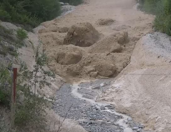
| Following the A.D. 900-930 Seattle Fault Earthquake, tsunami, and debris flow, Gorst Creek may have looked similar to this. Courtesy Pueblo City-County Health Department |
The sand layers deposited by the tsunami and Gorst debris flow can still be seen today in tidal channels along the bay, leaving stark reminders of the forces that wreaked havoc at the head of Sinclair Inlet 1100 years ago. Similar stories may exist elsewhere, yet to be discovered, but here at Gorst, the sediment record tells a story that presents itself as a clear and present reminder of the hazard that lies beneath our feet. Are you prepared?
Wow. I've researched this subject, but this is entirely fascinating news to me. Thanks.
ReplyDeleteHave you seen this? http://thomas-hopp.com/LandingPageEarthquake.html
I have not seen that but I will look into it. Thanks!
Delete