Showing posts with label Kitsap Waterfall Survey. Show all posts

Thursday, June 4, 2020

A New Perspective: The Ecologic and Geologic Oasis of Stephenson Canyon, Bremerton.

A sudden wave of nostalgia washed over me as I followed my friend and Kitsap Sun reporter Josh Farley into the depths of Stephenson Canyon. I had last stepped foot here over five years ago, at the very start of the "Kitsap Waterfall Survey" project. 

The canyon was filled with various shades of greens and browns, exploding with the growth of mid-spring. Carpets of sword ferns filled the understory, with large Big-Leaf Maples, Western Red Cedars, and Douglas Firs creating the canopy a hundred feet above our heads. And of course, down at the bottom, Stephenson Creek chattered away, beckoning. 

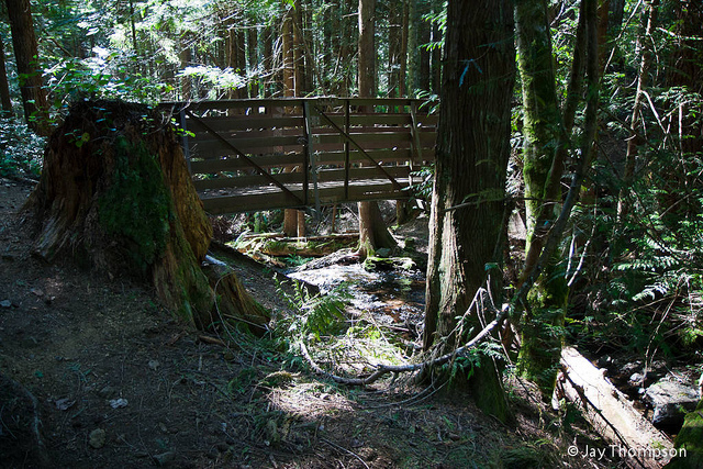
A "pocket wilderness" inside Bremerton city limits. 

I've learned so much since I first stepped into the canyon. In 2015 I couldn't have cared less what kind of plants and ecology the canyon hosted; I only cared about rocks. Now, I was taking it all in through a new set of skills and experiences. I looked up and around as well as down, remarking the enigma of such a beautiful Pacific Northwest oasis in the middle of a significant city. Craig Romano described it well in Urban Trails: Kitsap when he called it "...a pocket wilderness that feels like it can be deep in the Olympics." 

Of course, it wasn't entirely without flaw. Invasive English Ivy besieged several trees on the rim and down into the canyon, and trash and old city refuse was abundant. A community cleanup effort here would probably breathe some new life into the area, and the city would do well to pay more attention and protect this beautiful piece of borderline old-growth ecosystem. 

Moving on, we descended into the canyon and crossed the creek, moving our eyes away from the canopy and down to the ground. Various cobbles and boulders lined the stream channel, and the footpath traversed some small but textbook stream terraces that probably get a new layer of sand and mud every time the creek floods. 

Our main destination, of course, was "Stephenson Canyon Falls." The little cascade I "discovered" so many years ago. We rounded the corner, and the first words that flashed into my head were, "I'm an idiot." 

Back in 2015, I had no geology education other than a couple basic geology classes, and I hadn't done a whole lot of research on the geology of the bedrock underlying the Kitsap Peninsula. The extent of my knowledge was that most of the bedrock in the area was basalt. So I had assumed that the falls dropped over basalt. I was dead wrong. 

"Stephenson Canyon Falls" with slightly dipping beds of the Blakeley Formation
"Stephenson Canyon Falls" with slightly dipping beds of the Blakeley Formation. The Falls drop over possible sandstone, while the satchel sits on mudstone/siltstone.

"Stephenson Canyon Falls" actually drops over a resistant ledge of the "Blakeley Formation," a much younger rock with a completely different origin than the basaltic rock that makes up the Blue Hills. The area around the falls exposes two types of rock within the Blakeley Formation. The base of the falls is made up of siltstone or mudstone, and the falls themselves drop over what might be a sandstone with larger softball-sized class embedded within it. I have my own interpretations of what this layer might be, but I'm going to hold off on that until a later date after I do more research. 

Downstream of the falls, Stephenson Creek flows over and alongside some of the nicest Glacial Till deposits that I've seen on the Peninsula. Blue Gray concrete-like deposits form shelves and small embankments, peppered with glacial erratics and small potholes drilled during times of flooding or high water.


An exposure of glacial till with a carved pothole at the bottom of Stephenson Canyon. 

After viewing the falls and surrounding geology, it was time for Josh to head back. We made our way downstream again, where we stumbled upon an absolutely titanic Douglas Fir Tree, possibly an old-growth giant from before the first caucasian colonists arrived in Western Washington. It was a sight to behold and was a great symbol that despite the surrounding urban sprawl, Stephenson Canyon is still very much wild. 

Monday, February 5, 2018

Kitsap Waterfall Survey: "Lower Lost Creek Cascades"

Well over a year since I've last surveyed a waterfall on the Kitsap Peninsula, this was a nice return to form. Several months ago, a friend of mine mentioned to me the existence of a small cascading type waterfall on Lost Creek within publicly accessible land. With me being busy at CWU, it was put on the back burner at the time. Not anymore, This past weekend (2/4/2018) I joined my friend, his son, and their dog and set out to document and photograph this cascade with my own eyes.

Our waterfalling dog companion, Delilah.
A half-mile after it's opening fanfare, Lost Creek encounters another outcrop of Siletzia bedrock which underlies much of the Kitsap Peninsula. The canyon walls and creek bed become lined with a gorgeous blue-green-gray basaltic rock. After tripping over a small rapid in the shadow of a massive fir stump, the creek flows around a bend and slides over a ten-foot drop into a beautifully secluded alcove with a surprisingly deep plunge pool.

The initial 10-foot drop of "Lower Lost Creek Cascades" 
Immediately after this drop, the creek narrows from 10 feet wide to less than 3 feet and careens through a narrow slot cut into the rock, dropping an additional 4 feet in the process. The force of the water tearing through this slot has drilled large circular potholes into the bedrock, making interesting shapes and formations.

Lost Creek tearing through the small defile, with several large potholes in the foreground
Immediately after the main slot, the creek funnels through another bottleneck in the rock in a slide 3 feet high slamming into a jutting rock, taking a 90-degree turn to the left and bouncing over a couple small drops, before leaping over a messy 5-foot rock face. This final drop ends in a rocky alcove similar to the large one upstream. Shortly downstream, "Lower Lost Creek Cascades" terminates in a final small 3-foot slide, bringing the total height to ~25 feet.

The bedrock lining the creekbed. 
The geology of the canyon here is both fascinating and stunning. The underlying grey-blue gabbro rock sets the tone, peppered with red-brown pieces of basalt, and cut with white veins of quartz and calcite. In quieter pools and gravel bars, occasional light colored granite clasts can be found from the overlying glacial debris mantling the entire peninsula. At least at one spot within the cascade, I found evidence for faulting and the intrusion of volcanic andesite dikes 50 million years ago. I plan to write posts on both those geologic stories in the near future.


Wednesday, December 21, 2016

Kitsap Waterfall Survey: The Hidden Splendor of Lost Creek Falls

When I first began searching for waterfalls on the Kitsap Peninsula, one of the first things to catch my attention was the large canyon of Lost Creek. The creek digs a deep gouge over two miles in length west to east through thick glacial deposits, hugging the northern reaches of the Blue Hills. Upon further investigation and observation of the topographic maps, I began to realize that the head of the canyon likely housed one of Kitsap’s largest waterfalls, a hidden giant (in Kitsap terms) 50 feet high or greater. Reading the county parcel map, I also quickly realized that the location was inaccessible as the entirety of the hypothesized falls lied within private property - foiled again!
As my waterfall survey continued, and I checked more and more streams off the list, Lost Creek remained at the back of my mind. Finally, I caved. I sat down and wrote a detailed letter to the property owners along Lost Creek explaining my intentions and asking permission to access the creek. Rather rapidly I received confirmation from all of them; unfortunately, I moved to Central Washington University around the same time, and everything was put on hold. 
Fast forward to this Friday. I sent out an email to one of the property owners asking if it was still ok if I could investigate the falls on their property. I was surprised when I got a very kind reply back that I was more than welcome, in fact, I could come that same day. Throwing my waterfalling gear on and hurling myself into my truck, I made my way over to the Stephen family's property, perched on the precipitous canyon hiding Lost Creek. 

I was very fortunate and lucky that the Stephens family opened up their home and property for me to explore and run around on. That being said, the photos and report of these falls described here are for your reading only. The Stephens have asked that they would like these falls to remain off-limits to the general public, so please respect their wishes and enjoy the photos and detailed description I give here. Do not attempt to reach these falls.

I arrived at the Stephens' property not sure what to expect. I was greeted by Katie and Joe, who grew up on the property, and they happily led me down several trails to the bottom of the canyon, showing the best access points. They returned to the house to let me scamper along the creek. Here's what I observed.
The first 10 foot drop of the upper cascades. Photo By Micah K. 
Lost Creek babbles onto the Stephens'  property in a quiet, unassuming fashion with musical chattering echoing through the leaves. Shortly after passing the property line, its character rapidly changes. The creek skitters over a tiny shelf of brown bedrock and picks up speed, flowing past a gravel bar and then crashing 10 feet over a brown mass of bedrock into a small plunge pool. Across this plunge pool from the face of the falls is a large outcrop of grey blocky bedrock. The creek skips around this and begins a series of small drops into a deep gorge. I didn’t have the time to explore this gorge in detail, but there is at least one 10 foot drop at its head and a 5 foot drop at the bottom, making this initial cascade at least 25 feet high.
The final drop on the upper cascades. Photo by Micah K.
After this gorge, the creek takes a brief rest, flowing alongside a massive gravel bar of shattered bedrock and occasional glacial erratics transported from the north tens of thousands of years ago. After squeezing through a logjam, the creek begins its chaotic downward tumble again. As soon as the creek escapes the tangled mass of logs, it spreads out across a broad, grooved shelf of grey-blue bedrock that spans the entire floor of the canyon. The creek hisses across this shelf and loses 10 feet of elevation in around 60 feet of run. This shelf ends abruptly in a small 4-5 foot plunge into a beautiful and hauntingly deep pool. Upon exiting this pool, the creek works its way through another loose logjam and immediately hurtles 15 feet over a spectacularly photogenic block into a gorgeous blue-green pool. Without pause, the creek crashes over another  15 foot cascading slide, pooling at the base of a cliff of grey rock. After a short turn around the cliff, the creek trips over a 4 foot rib of rock and flows quietly for 30-40 feet.  

the most significant tier of "Lost Creek Falls" 

After navigating past another small logjam, the creek hurtles 10 feet over a rugged ledge, turns, and dives over what appears to be another 10 to 15 foot drop jammed between two ribs of rock. I was only able to view this final drop from the top, and from my vantage point perched on the precipitous walls of the canyon, the creek calmed down following this and flowed around the corner out of sight. However, I know that the whitewater doesn't stop there, as neighbors downstream have reported several waterfalls on their property. It is inevitable that I will have to strap on my waders once more and return to Lost Creek to finish the survey I started, and I hope that day comes soon. Until then, I am currently analyzing and identifying the rock types that make up the bedrock at these falls and hope to do the same at other falls around Kitsap. 

The second main tier of "Lost Creek Falls." Note the first main tier peeking out in the background. Photo by Micah K. 

Thank you to the Stephens family for opening up their home and canyon to me for exploring! This blog post wouldn't have been possible without their hospitality. 

Tuesday, November 8, 2016

Kitsap Waterfall Survey: Upper Dickerson Creek.

Thus far, I have written about four of Dickerson Creek's waterfalls: "Elegance," "Divergence," "Dickerson Creek", and "Beaver Dam Lake Falls." Finally, I'm crossing off the final two waterfalls. Both are located on upper Dickerson Creek before it enters Beaver Dam Lake.

Dickerson Creek spawns in a marshy lake in southwestern Ueland Tree Farm. There are several lakes like this on the farm, resting in valleys gouged out by the glaciers that covered the Kitsap Peninsula 17,000 years ago. After it exits the lake, the first half-mile of Dickerson Creek is calm, flowing through the dense second-growth forest. This quiescence is cut short as the creek encounters the first rock layer on its tumultuous journey to Chico Creek.

"Cedar Gorge Falls" The first waterfall on Dickerson Creek. Photo by Micah K.
What the first waterfall on Dickerson Creek lacks in height, it makes up for in character. Here the creek intersects a basalt ledge and dives ten feet into a shaded, dark pool carved into the head of a steep-sided gorge. Several young cedar trees overhang this pool, adding to the shaded environment. For the presence of these trees and the overall location of this fall, I have named it "Cedar Gorge Falls."

"Upper Dickerson Falls" upper tier. Photo by Micah K. 

Flowing for another 60-70 feet and around a slight corner, the creek exits the gorge and drops over another, more striking fall. This is "Upper Dickerson Falls" This waterfall is composed of two tiers totaling about 30 feet in height. The first tier begins as a shallow cascade hissing over orange-red colored basalt which rapidly steepens into a final slide into a shallow basin. In low to medium water levels, only a small portion of the basalt face has water flowing over it, but I imagine in the height of winter or after a heavy rain, the entire shelf is one roaring mass of violent whitewater.

Between the two tiers is a section of level creekbed with a bottom of rounded stones. These stones range in composition from the basalt of the falls to pink-tan granites transported onto the Kitsap Peninsula from the northern cascades by the ice-age glaciers.

The second tier would be as gorgeous as the first, if it weren't for the two massive logs that have fallen across it, effectively blocking half from view. Despite this eyesore, the color of the bedrock is a mesmerizing dark blue-purple. At the base of the falls is another large piece of bedrock checkerboarded red and blue with white mineral veins crisscrossing the surface. Not only is this one of the most visually pleasing falls in the county, but it's also one of the best geologic outcrops Kitsap has to offer too.

"Upper Dickerson Creek Falls" bottom tier, Photo by Micah K.

Monday, October 31, 2016

Kitsap Waterfall Survey: Changing scenery at "Heins Creek Falls"

The upper tier of "Heins Creek Falls" with scale.
Photo by Micah K. 
On Sunday 10/30/2016 I visited one of my favorite falls in the area, "Heins Creek Falls" and was delighted to find that the recent rains have reinvigorated the creek and the falls were roaring with jubilee.

Everything about the first tier appeared to be in order, so I moved down to the second tier, which I haven't seen up close since the last time I first discovered the falls over a year and a half ago. What I found surprised me greatly.

If you read my original write up about this falls, you will find that I describe the second drop of this falls as slipping through a large logjam which is damming up the creek before it plunges 20 feet into a crevice. Well....things have changed a little bit.

When I arrived at the second tier, it had changed it's appearance drastically. The logjam has apparently settled even more since my last visit, and is beginning to block water flow from above. As a result, nearly half the volume of the creek is now plunging over the cliff over 30 feet from where it originally was. A swath of hillside that used to be covered in ferns, leaves, and soil is now bare basalt with roaring whitewater tumbling over it. The resulting display is absolutely spectacular.

The second tier of "Heins Creek Falls." Photo by Micah K. 


Monday, April 11, 2016

Kitsap Waterfall Survey: "Dickerson Falls"

This will probably be my last Kitsap Waterfall post for some time due to being at Central Washington University for the next several months, but I wanted to get it out before the summer.

I have made the decision to combine two waterfalls, "Cleft Falls" and "Cable Falls" on Dickerson Creek. I was able to visit these two falls on my last major waterfall survey after I found "Melange Falls" and "Cedar Gorge Falls" (which will have a write up about them in the summer or fall.)

My reasoning for combining these two falls is that they are extremely close together, mere feet. So in hindsight, I think they are really two drops of one large fall. My reason for not deciding to do this when I first discovered them is, quite simply, I was inexperienced and hadn't made up my "requirements" for the survey. So now, I'm going back and correcting that.

So, since both of these falls are being combined, the names "Cleft" and "Cable" are going to be dropped and I'm going to rename this waterfall "Dickerson Falls" after it's source creek, and since that's what the Ueland Tree Farm calls it. It is also sometimes referred to as "Chico Falls" by locals.

The upper horsetailing tier of "Siletzia Falls" at moderate flow. Photo by Micah K. 


"Dickerson Falls" begins immediately after Dickerson Creek pours over a small abandoned concrete dam which backs up the creek to form Beaver Dam Lake. The first tier cascades five to ten feet before horsetailing over a large basalt shelf around 20 feet into a large plunge pool, which is frequently used as a swimming hole during the summer. After exiting the plunge pool, the second tier begins. The second tier cascades 20 to 25 feet over a big buttress of blocky basalt, it's rather ugly: crisscrossed with huge downed trees and several old logging cables. Below the falls the creek heads into a narrow gorge with some smaller cascades and rapids, before continuing down the canyon.


Saturday, January 30, 2016

Kitsap Waterfall Survey: "Claire Falls"

There are multiple places in Washington State where a very respectable and sometimes spectacular waterfall is nearly eclipsed by an even bigger one nearby. It just so happens that there is one of these situations in Kitsap County. It turns out, "Tin Mine Falls" has a much smaller sibling.

During the wet times of the year (fall/winter/spring), small ponds and rain runoff give rise to a quaint little brook along the mountainside between Tin Mine Creek and a smaller tributary to the west. This tiny stream, nearly imperceptible on topographic maps and imagery, babbles through the forest, running generally northeast, straight towards Tin Mine Creek's canyon. Just downstream of "Tin Mine Falls," the brook intersects the near-vertical basalt canyon wall of and promptly dives over it. The resulting 40+ foot ribbon-like waterfall is startlingly beautiful, and would be commanding the attention of everything around it if it wasn't dwarfed by its colossal neighbor.

The lower section of "Claire Falls" as it's namesake looks on. Photo by Micah K. 
It is likely that this fall runs dry by July or August, but when it is flowing, it is a beautiful sight indeed, and so I have it included in my survey. After I first saw it in January 2015, I was trying to think of a name for it for months. One day a good friend of mine visited, and I took her to see "Tin Mine Falls." While she enjoyed "Tin Mine Falls" immensely, she also took an extreme liking to this little ephemeral fall. Because of this, I decided to name the fall after her.  

Monday, January 18, 2016

Kitsap Waterfall Survey: "Wright Creek Cascades"

When I first investigated Wright Creek on the western outskirts of Bremerton and surveyed "Wright Creek Falls," I immediately realized that the creek probably had more to offer as it bounced its way down to Sinclair Inlet. I have since visited "Wright Creek Falls" multiple times, and each time got me more and more frustrated at the difficult access downstream of the falls, which appeared to have steep slopes and thick brush. I finally decided that the best way to survey downstream was going to be walking down the stream itself.

I was really hoping that the search would be relatively straight forward, just walk down the creek until I hit a cascade or waterfall. I should have known better. For the next three hours I was in the creek as often as I was out of it. Being out of the creek involved fighting foot-for-foot through Devil's Club, Salmonberry, Swordfern, Salal, and Evergreen Huckleberry. Being in the creek resulted in teeth chattering temperatures, slippery rocks, and hidden pools in the creek which at some points almost sent me up to my waist.

A small unnamed cascade on Wright Creek. Photo by Micah K. 

After passing a few small rapids and interesting little cascades, shin deep in the chilly water, my frustration was mounting. I finally came to a sharp bend in the creek, and as I stepped around it I was immediately met with the thundering roar of crashing water.

"Wright Creek Cascades," Photo by Micah Kipple.
Unfortunately there is a serious foreshortening of the cascades in this photo so they appear smaller than they are in actuality. 
1,100 feet downstream of "Wright Creek Falls," Wright Creek narrows and rockets through a small basalt gorge, this gorge is occupied by "Wright Creek Cascades." The cascades begin immediately after the creek is dammed up behind a small logjam. Composed of three main drops, the cascades total about ten feet in height. Below the cascade the creek appears to calm down, with only one more section of rapids before continuing down towards the Inlet.


Tuesday, January 12, 2016

Kitsap Waterfall Survey: "Heins Creek Cascades"

Heins Creek in the southeastern portion of the Ueland Tree Farm  has already revealed a major waterfall: "Heins Creek Falls", which crashes over 50 feet just before entering Heins Lake. But I have long suspected the creek has more in store as it winds its way down from the Blue Hills.

Some of the reddish basaltic bedrock in the streamed. Photo by Micah K. 
Just under a half mile upstream of "Heins Creek Falls," Heins Creek encounters another layer of basalt bedrock. While the resulting cascades are not nearly as spectacular as its larger cousin downstream, they're still respectable, set in a beautiful green setting and bouncing off of colorful rocks. Here the creek trips over a long series of drops over the course of about 100 feet, similar to the layout of "Gold Creek Cascades" on the other side of the Hills. The total height of this cascade is about 25 feet, well above the ten foot requirement for my survey. It should be noted that this point in the creek may experience times of very low flow during summer months.


The uppermost section of "Heins Creek Cascades," Photo by Micah Kipple. 


Wednesday, December 30, 2015

Kitsap Waterfall Survey: Social Media.

The Kitsap Waterfall Survey is now on social media!


Instagram: @Geologicadventures

These accounts will be updated whenever something new happens in the survey, probably once every one or two weeks. With another quarter at Olympic College beginning on Monday, the survey will be slowing down, with waterfall searches and research happening on weekends or days off after school and work has been taken care of. 

Happy New Year! Here's to discovering some more of Kitsap's hidden wonders in the future! 

Friday, December 25, 2015

Kitsap Waterfall Survey: "Beaver Dam Lake Falls"

It's been almost a year since I've surveyed any portion of Dickerson Creek in the Ueland Tree Farm. The lower portion of this creek has three major waterfalls after it exits Beaver Dam Lake; these have been described here and here.

However, Dickerson Creek doesn't start at Beaver Dam Lake, it's source is much further south in another small unnamed lake higher in the hills near the southwestern boundary of the tree farm. Using Google Earth software I determined that the creek most likely has two falls or cascades between its headwaters and Beaver Dam Lake. On Christmas day I confirmed one of these.

The lower tier of "Beaver Dam Lake Falls." Photo by Micah K. 
Shortly before entering Beaver Dam Lake, Dickerson Creek crosses an old logging road. Just north of this road, the creek drops 22 feet in 3 steps over a basalt formation, creating a beautiful tiered cascading waterfall. 


Monday, December 21, 2015

Kitsap Waterfall Survey: Tin Mine Creek Revisit 12/13/15

The week prior to December 13, the Kitsap Peninsula had enjoyed a thorough and much needed dousing of steady rain. The creeks predictably swelled in response, and I knew exactly where I wanted to go first. It had been nearly eight months since the last time I visited "Tin Mine Falls" back in March, and it was time to go see the survey's largest waterfall again.

Tin Mine Falls 12/13/15
Photo by Micah K.
Hiking up the dampened GM-1 road, it became quickly apparent there was going to be a lot of water in the creek. Every little side gully and low spot had water in it, and the branches were still dripping. 40 minutes after parking the car, My hiking partner and I finally arrived at the creek. When my friend Spencer and I had first discovered Tin Mine in January 2015, it was full of water, crashing through the basalt canyon. I didn't think it would be possible for the creek to get any more filled, but apparently it is; the swollen spectacle that greeted us on December 13 was nothing short of astounding. The creek was absolutely thundering through the canyon. Arriving at the best spot for viewing I like to call "The Overlook" I came face to face with the entire display.

It became readily apparent to me that we weren't going to be able to make it to the bottom of the largest tier, which requires scrambling up and over the lowest tier of the falls. The amount of water made it nearly impossible, if not downright dangerous. So after watching and photographing "Tin Mine Falls" for a few minutes, we moved towards "Echo Falls," and got another shock.

Usually I access "Echo Falls" by rock hopping across the creek about 50 feet upstream of the falls. This is no longer possible. It appears one of the many windstorms that has slammed the peninsula recently caused 3-4 large pine trees to fall into the creek, shattering and creating a natural dam. The creek has pooled up 3-4 feet deep behind this dam, inundating the once perfect crossing, it's now wade across, or cross a log a little bit more upstream.

Once we successfully crossed to the other side, we scrambled down to "Echo Falls". For the first time I have seen, It was completely full. Words can almost not do it justice.

Echo Falls 12/13/15
Photo by Micah K. 


Sunday, November 29, 2015

Kitsap Waterfall Survey: "Kerplunk Falls"

This fall was surveyed a while ago. But I had never written a post about it, so I have decided to fix that.

Lost Creek is one of the largest creeks flowing out of the Blue Hills. It comes down off the eastern slopes of Green Mountain and flows east until it joins with Wildcat Creek to form Chico Creek, which is has one of the best salmon runs on the Kitsap Peninsula. I had long suspected Lost Creek to have a fall somewhere along it's upper reaches, assuming it was a permanent stream. I made the 2 mile hike around Green Mountain to where an old logging road crosses the incipient creek.

Starting upstream, I almost immediately entered into a deep basalt gorge lined with old pillow lava, through which Lost Creek flowed. I scrambled and fought my way up the gorge, becoming rapidly frustrated with the lack of vertically falling water. Finally, probably about 300 or so feet up the canyon, I found a fall, sort of.

"Kerplunk Falls" 
As the creek takes a sharp righthand bend, it has become dammed up with a rather impressive logjam immediately over a small 10 foot basalt ledge. After filtering through the logjam, the creek plunges straight down over the drop, landing in a shallow alcove and continuing along its way. When I first observed this fall, the appearance of the logjam reminded me of the child's game Kerplunk and so I have tentatively named this small waterfall "Kerplunk Falls"

I suspect this canyon has more to offer above "Kerplunk," however at the time of the survey, I was too exhausted to continue further up the canyon, I scrambled up to the rim and began walking back down towards the road. As I walked down the slope along the rim, I noticed numerous signs of bear frequenting the area, A reminder that this is bear country.


Wednesday, November 25, 2015

Kitsap Waterfall Survey: "Contact Cascades"-My 20th waterfall!

Following my lecture at the Norm Dicks Government Building in Bremerton, one of the audience members came to me and told me of a waterfall on the Beaver Pond Trail within the Green Mountain State Forest. Their description seemed to indicate something small, but they insisted it was over bedrock, and so I decided to investigate.

As the wind howled through the trees and branches of various sizes fell all around, I hiked up the side of Green Mountain until I reached the Beaver Pond Trail. Within a few hundred feet, the trail crosses over Grata Creek, a stream running down the northwest side of Green Mountain. Grata Creek has long been on my radar, as it drops rather rapidly from high up on the mountain slopes before emptying into Tahuya Lake.

Lidar imagery map of Grata Creek. 
Even with these suspicions, I realized that most of the creek was bounded by private property, and so any falls and cascades would be inaccessible to me. Grata Creek originates on a spring fed lake tucked at the head of a forested valley at about 950 feet. The creek flows from this lake and bypasses another lake. It is after this second lake the creek steepens significantly and the private property begins. This is is the only place I thought falls would occur. I was wrong

Shortly after exiting its source lake Grata Creek meanders through some open pine forest, then less than a quarter mile later, it passes underneath the Beaver Pond Trail bridge, and immediately skips over a series of wonderful cascades over 20 feet in height, right next to the trail and very easily visible.

Bridge over Grata Creek
On my survey I was only able to observe 4 tiers in detail, there may be one or two below these, but I was unable (and really, unwilling) to fight through the thick brush to see them, so they will have to wait for a later visit. Of the tiers I did observe:

 The cascade begins with a five foot sliding drop over some beautifully dark volcanic rock called  Gabbro.

First tier "Contact Cascades" 
The second tier is a little more complex; two-thirds of the creek pours into a deep crack in the bedrock, while the remaining portion slides gradually down the rock. Here some interesting geology is seen. On the north side of the stream the bedrock is composed of the Gabbro the first tier goes over, but on the south side of the stream the rock is Basalt, which upon close observation, has even formed into small disorganized six-sided columns. In geology, the term used for where two different rock types meet is called a "contact." Thus, since this cascade appears to occur on a contact, I have named it "Contact Cascade."

Second tier of "Contact Cascades" 
The third tier is a small little three footer choked with forest debris and relatively ugly, the 4th tier is a long sliding cascade probably five or six feet high. After this the creek appears to go over at least one more drop, but heavy brush prevented me from getting an up close look.

Thanks to the person who suggested this fall to me. It is a great contribution to the survey!

One final thing to note, "Contact Cascade" is my 20th surveyed waterfall! Hard to believe I've made it this far after starting this project a year ago. Who knows, maybe I'll find 20 more!

Sunday, November 22, 2015

Kitsap Waterfall Survey: "Downfall Creek"

"Downfall Creek" is the working name I have for the small creek that drops off the southwest side of Gold Mountain in the Blue Hills before emptying into Mission Lake. The creek is broken up into two main sections: The dividing line between these sections is a logging road located several hundred feet up the side of Gold Moutain which crosses the creek at an elevation of about 930 feet. Or 360 vertical feet above Mission Lake.

The lower section of the creek, which drops from the above-mentioned logging road down to Mission Lake, is probably permanent; during extremely dry seasons it may run dry, but based on the appearance of the canyon and the stream, it flows to some degree year round. Here the creek has incised a deep canyon has it flows down the hillside. In places this canyon is over 90 feet deep. The walls are covered in forest debris and thick stands of brush, making travel arduous and tricky.

Above the logging road, the creek forks into two smaller segments, it is unlikely that either of these are permanent. Despite this, there are reports of a 15' tall cascade somewhere along this section, at least when water is flowing.

My hiking partner and I surveyed the Lower Section of the creek on November 18. We started up the old logging road that headed into the clearcut, then cut cross-country and went into the canyon. Within moments of entering the canyon, we stumbled across a small, cascade, which almost didn't warrant a second glance from me. Then when my partner stood next to it. It became apparent the cascade just barely met the height requirement for my survey if you combined the two tiers, which were about 15 feet apart. The upper tier is a four foot plunge, while the lower tier is a six foot cascade twisting through a blocky chunk of basalt bedrock. For it's twisting appearance, I named this cascade "Corkscrew Cascade."

"Corkscrew Cascade" 
Moving up the creek, thick brush and extremely steep slopes forced us to cross the creek and scramble up to the rim of the canyon where we were assaulted by waist high brush and and unstable ground. Moving cautiously, we crested a rise, and my friend called out to me, pointing upstream. Looking towards where he was pointing, suddenly I saw it. Above us, and several hundred feet away, a streak of whitewater could be seen pouring over a rock face, disappearing from view into the canyon. We rapidly made our way to the fall, and scored.

Almost exactly halfway up the canyon, "Downfall Creek" drops over a 56 foot tiered waterfall. The fall begins with a six foot slide, where the creek gathers momentum before it rockets over a fifteen foot plunge into a narrow alcove which houses a shallow small plunge pool. Immediately following this plunge, the creek continues to cascade at least another 30-40 feet down to the bottom of the canyon below.

Looking over the brink of "Midway Falls" 
Continuing up the canyon, we travelled along the rim, having crossed the creek a second time. Several hundred feet above "Midway Falls," We viewed another waterfall. This fall is probably comparable in size to "Midway" but due to the amount of deadfall and debris impairing views of the creek and the falls it was hard to tell. I did observe one tier that appeared to be about 10-15 feet, high, and then a long series of steep cascades below that. Since I only viewed this fall from a distance and have not been able to accurately observe it up close it remains confirmed, but not surveyed on my digital map.

"Midway Falls" With hiking partner Spencer. 

Monday, November 16, 2015

Kitsap Waterfall Survey: "Heins Creek Falls" Revisit, November 15, 2015

Today I had the pleasure of leading two reporters from the Kitsap Sun newspaper to "Heins Creek Falls." A story by the Kitsap Sun is out to precede my lecture on Thursday.

The day started out almost perfect: overcast skies with almost no wind and a comfortable temperature. I had high hopes as I went through my classes of the day at OC. Unfortunately, Washington had other plans. As soon as I stepped foot outside the building of my last class the sky opened up, and continued raining for the majority of the day. At 2pm I was scheduled to meet up with the reporting team; they arrived right on schedule.

Not wasting any time, we trudged up to the railroad tracks and started toward our destination. We passed by Kitsap Creek, and peered up at "White Train Falls" through the trees; the water was tinted a slight tan color and roared through the canyon. With that much water I doubted I would ever be able to make it up to the fall the way I did before.

"Heins Creek Falls" at high water/flood stage
Finally, after what seemed like a long while of trudging through the ceaseless rainfall, we rounded the bend and the roar of a swollen Heins Creek came to meet us. Scrambling up the sopping almost unrecognizable path to the main tier, my excitement grew exponentially as more and more of the falls came into view; it was absolutely torrential.


Heins Creek was probably two feet higher than normal water level in some places. The main 20 foot tier, which normally is a graceful segmented sliding cascade, was a careening mass of foaming whitewater crashing down the basalt face. In some places, the water hit jutting outcrops of basalt with enough force to create small but powerful rooster tails. When the creek encountered the massive logjam, instead of draining through it, the astounding amount of water was forcing the creek to flow over the logs, plunging down into the large alcove. The final 10 foot cascading section was still recognizable, but a lot more violent as well.

As well as being extremely excited myself, I was pleased to look over and see the reporters with smiles etched on their faces. One remarked "I never knew something like this even existed in Kitsap, this is amazing." Watching waterfalls alone is one thing, but seeing people's reactions to their first sight of them sometimes is even better.

Video of the Falls. 

Tuesday, November 10, 2015

Waterfall Lecture, Thursday 11/19

To all readers and anyone who is interested. I will be giving a lecture on the Kitsap Waterfall Survey on Thursday, November 19, in the Norm Dicks Government building in downtown Bremerton. The lecture will be from 1:30-3pm You can sign up using this link! Seats could go fast!

Sunday, October 11, 2015

Kitsap Waterfall Survey: Upper Wildcat Creek

Wildcat Creek is one of Kitsap County's largest salmon streams, producing healthy runs of Chum and Coho salmon each year. Being one of Chico creek's largest tributaries, it has naturally been on my radar for some time.

Upper 5' section of "Bobcat Cascade"

Wildcat Creek is born in the same natural saddle that houses Tin Mine Lake; drained to the west by Tin Mine Creek. After flowing out of the saddle, even after heavy rains, Wildcat Creek is small, being only 3-5 feet wide at most and less than a foot deep. It meanders through the forested valley for less than a mile before it is crossed by Rock Quarry Road, and several hundred feet later, Wildcat Trail.

100-200 feet after the trail bridge, Wildcat creek encounters the basalt formations that make up the core of the Blue Hills. The creek drops over the first layer in a rather unimpressive two tiered cascade with respective drops of 5 and 10 feet. For the small size of this cascade, and for it's location on Wildcat Creek, I named it "Bobcat Cascade."

Somewhat disappointed at the size of the cascade, I forced myself to continue following the small creek, passing several more cascades to small to be included in the survey. Convinced that the creek had more to offer, I pushed downstream, crawling over logs, traversing steep slopes, and hoping there was another cascade or fall further down. Sure enough, I rounded a corner and the sound of hissing water echoed throughout the canyon.

After another several dozen feet, I found myself standing on the brink of a very steep, multi-tiered cascade, crashing down a rugged face of black basalt. Scrambling down alongside the fall, I carefully took notes of the different drops and their heights, here's what the results were:

Looking up the largest cascading drop of "Cougar Falls" 

The falls consists of 3 main sections, all within about 150 feet of stream length.

The first section consists of a one foot, two foot, and four foot drop.
The second section is that largest, with a fifteen foot steep cascading drop.

The third section is a seven foot shallow cascade over basaltic rock with a striking orange-red color, bringing the total height of this fall to thirty-five feet.

Third bottom section of "Cougar Falls" note the tawny color of the rocks. 


This orange color, which shows up in other parts of the basalt gorge the creek runs through; reminded me of the color of a Cougar, and thus, keeping in the theme of Wildcats, I named this fall, "Cougar Falls"

Thursday, April 30, 2015

Kitsap Waterfall Survey: "Wright Creek Falls"

Wright Creek is a small creek sandwiched between the Blue Hills and the western outskirts of Bremerton. Its headwaters begin in a small series of spring-fed wetlands on peak 730's eastern slope. A few hundred feet after exiting these wetlands, the stream drops into a small canyon just southwest of Bremerton's #3 reservoir. At the head of this canyon is a ten-foot-high basalt headwall covered with a thick layer of green mosses. Wright Creek plunges over this headwall into a shallow plunge pool in the form of a small, but startlingly pretty twelve-foot horsetail waterfall. Upon exiting the pool, the creek steps down several small basalt ledges, before heading into the thick growth of the canyon.

"Wright Creek Falls" during moderate flow.

 About 100 feet to the northeast of "Wright Creek Falls" is a tributary of Wright Creek with its own name; Charlston Creek, which drains a separate set of marshes to the north. Charlston Creek encounters the same basalt outcrop as Wright Creek and careens down a set of bouncing cascades 15 feet high. Only the top few feet of the cascades can be seen because the rest disappears under an impressive logjam that crosses the tributary. The logjam is so compact that soil has formed on the top and forest undergrowth is flourishing, creating a natural tunnel. Because of this feature, I have tentatively named the cascade, "Tunnel Cascade."

The upper portion of "Tunnel Cascade" on Wright Creek's Tributary. Photo by Micah K.
I know of another waterfall or cascade on Wright Creek reportedly large enough that it blocks all fish passage upstream, but unfortunately this fall is likely on private property. However, Wright Creek does have another feature downstream of "Wright Creek Falls," Which is discussed here 

Saturday, March 7, 2015

Kitsap Waterfall Survey: Making breakthroughs and finding traction.

This week two large things happened involving the Kitsap Waterfall Survey that I felt the need to write about. The first being that three of the waterfalls on Dickerson Creek have made it onto the Northwest Waterfall Survey  and the World Waterfall Database. While obviously not standing in the spotlight out of the thousands of falls logged in those sites, just seeing Kitsap County on the map gives me a profound sense of accomplishment. And part of the whole reason that this survey was started was to help "fill in the blank" that was Kitsap County, so I guess you can say that was a success. The man in charge of the Pacific Northwest Waterfall Survey has also told me "Tin Mine Falls" is on the cue to be added to the two databases as well. How exciting!!!

Largest Tier of "Tin Mine Falls," on Tin Mine Creek.
Photo by Micah K. 
The second item of the week is a discovery of mine that can help move this survey along incredibly. It is a fish habitat report for the entirety of the Kitsap Peninsula, included in this report are detailed maps of different sections of Kitsap County, these maps show streams, rivermiles, logjams, beaver dams, manmade dams, and most importantly; Cascades and Waterfalls!. I was not expecting the sheer goldmine this report was. Not only has it marked these water features, but it has also color coded the cascades and waterfalls that are impassable to fish, allowing me to pinpoint where I want to investigate. Now as exciting as this find is, I am almost certain more than half of these "impassable cascades" could be ephemeral, small streams or possibly even dry watercourses that would be nowhere close to meeting the criteria of my survey. Still this is an amazing jump pad to future investigations, and should be a huge help in my continuing search for waterfalls in Kitsap.