These accounts will be updated whenever something new happens in the survey, probably once every one or two weeks. With another quarter at Olympic College beginning on Monday, the survey will be slowing down, with waterfall searches and research happening on weekends or days off after school and work has been taken care of.
Happy New Year! Here's to discovering some more of Kitsap's hidden wonders in the future!
It's been almost a year since I've surveyed any portion of Dickerson Creek in the Ueland Tree Farm. The lower portion of this creek has three major waterfalls after it exits Beaver Dam Lake; these have been described here and here.
However, Dickerson Creek doesn't start at Beaver Dam Lake, it's source is much further south in another small unnamed lake higher in the hills near the southwestern boundary of the tree farm. Using Google Earth software I determined that the creek most likely has two falls or cascades between its headwaters and Beaver Dam Lake. On Christmas day I confirmed one of these.
The lower tier of "Beaver Dam Lake Falls." Photo by Micah K.
Shortly before entering Beaver Dam Lake, Dickerson Creek crosses an old logging road. Just north of this road, the creek drops 22 feet in 3 steps over a basalt formation, creating a beautiful tiered cascading waterfall.
The week prior to December 13, the Kitsap Peninsula had enjoyed a thorough and much needed dousing of steady rain. The creeks predictably swelled in response, and I knew exactly where I wanted to go first. It had been nearly eight months since the last time I visited "Tin Mine Falls" back in March, and it was time to go see the survey's largest waterfall again.
Tin Mine Falls 12/13/15
Photo by Micah K.
Hiking up the dampened GM-1 road, it became quickly apparent there was going to be a lot of water in the creek. Every little side gully and low spot had water in it, and the branches were still dripping. 40 minutes after parking the car, My hiking partner and I finally arrived at the creek. When my friend Spencer and I had first discovered Tin Mine in January 2015, it was full of water, crashing through the basalt canyon. I didn't think it would be possible for the creek to get any more filled, but apparently it is; the swollen spectacle that greeted us on December 13 was nothing short of astounding. The creek was absolutely thundering through the canyon. Arriving at the best spot for viewing I like to call "The Overlook" I came face to face with the entire display.
It became readily apparent to me that we weren't going to be able to make it to the bottom of the largest tier, which requires scrambling up and over the lowest tier of the falls. The amount of water made it nearly impossible, if not downright dangerous. So after watching and photographing "Tin Mine Falls" for a few minutes, we moved towards "Echo Falls," and got another shock.
Usually I access "Echo Falls" by rock hopping across the creek about 50 feet upstream of the falls. This is no longer possible. It appears one of the many windstorms that has slammed the peninsula recently caused 3-4 large pine trees to fall into the creek, shattering and creating a natural dam. The creek has pooled up 3-4 feet deep behind this dam, inundating the once perfect crossing, it's now wade across, or cross a log a little bit more upstream.
Once we successfully crossed to the other side, we scrambled down to "Echo Falls". For the first time I have seen, It was completely full. Words can almost not do it justice.
This fall was surveyed a while ago. But I had never written a post about it, so I have decided to fix that.
Lost Creek is one of the largest creeks flowing out of the Blue Hills. It comes down off the eastern slopes of Green Mountain and flows east until it joins with Wildcat Creek to form Chico Creek, which is has one of the best salmon runs on the Kitsap Peninsula. I had long suspected Lost Creek to have a fall somewhere along it's upper reaches, assuming it was a permanent stream. I made the 2 mile hike around Green Mountain to where an old logging road crosses the incipient creek.
Starting upstream, I almost immediately entered into a deep basalt gorge lined with old pillow lava, through which Lost Creek flowed. I scrambled and fought my way up the gorge, becoming rapidly frustrated with the lack of vertically falling water. Finally, probably about 300 or so feet up the canyon, I found a fall, sort of.
"Kerplunk Falls"
As the creek takes a sharp righthand bend, it has become dammed up with a rather impressive logjam immediately over a small 10 foot basalt ledge. After filtering through the logjam, the creek plunges straight down over the drop, landing in a shallow alcove and continuing along its way. When I first observed this fall, the appearance of the logjam reminded me of the child's game Kerplunk and so I have tentatively named this small waterfall "Kerplunk Falls"
I suspect this canyon has more to offer above "Kerplunk," however at the time of the survey, I was too exhausted to continue further up the canyon, I scrambled up to the rim and began walking back down towards the road. As I walked down the slope along the rim, I noticed numerous signs of bear frequenting the area, A reminder that this is bear country.
Following my lecture at the Norm Dicks Government Building in Bremerton, one of the audience members came to me and told me of a waterfall on the Beaver Pond Trail within the Green Mountain State Forest. Their description seemed to indicate something small, but they insisted it was over bedrock, and so I decided to investigate.
As the wind howled through the trees and branches of various sizes fell all around, I hiked up the side of Green Mountain until I reached the Beaver Pond Trail. Within a few hundred feet, the trail crosses over Grata Creek, a stream running down the northwest side of Green Mountain. Grata Creek has long been on my radar, as it drops rather rapidly from high up on the mountain slopes before emptying into Tahuya Lake.
Lidar imagery map of Grata Creek.
Even with these suspicions, I realized that most of the creek was bounded by private property, and so any falls and cascades would be inaccessible to me. Grata Creek originates on a spring fed lake tucked at the head of a forested valley at about 950 feet. The creek flows from this lake and bypasses another lake. It is after this second lake the creek steepens significantly and the private property begins. This is is the only place I thought falls would occur. I was wrong
Shortly after exiting its source lake Grata Creek meanders through some open pine forest, then less than a quarter mile later, it passes underneath the Beaver Pond Trail bridge, and immediately skips over a series of wonderful cascades over 20 feet in height, right next to the trail and very easily visible.
Bridge over Grata Creek
On my survey I was only able to observe 4 tiers in detail, there may be one or two below these, but I was unable (and really, unwilling) to fight through the thick brush to see them, so they will have to wait for a later visit. Of the tiers I did observe:
The cascade begins with a five foot sliding drop over some beautifully dark volcanic rock called Gabbro.
First tier "Contact Cascades"
The second tier is a little more complex; two-thirds of the creek pours into a deep crack in the bedrock, while the remaining portion slides gradually down the rock. Here some interesting geology is seen. On the north side of the stream the bedrock is composed of the Gabbro the first tier goes over, but on the south side of the stream the rock is Basalt, which upon close observation, has even formed into small disorganized six-sided columns. In geology, the term used for where two different rock types meet is called a "contact." Thus, since this cascade appears to occur on a contact, I have named it "Contact Cascade."
Second tier of "Contact Cascades"
The third tier is a small little three footer choked with forest debris and relatively ugly, the 4th tier is a long sliding cascade probably five or six feet high. After this the creek appears to go over at least one more drop, but heavy brush prevented me from getting an up close look.
Thanks to the person who suggested this fall to me. It is a great contribution to the survey!
One final thing to note, "Contact Cascade" is my 20th surveyed waterfall! Hard to believe I've made it this far after starting this project a year ago. Who knows, maybe I'll find 20 more!
"Downfall Creek" is the working name I have for the small creek that drops off the southwest side of Gold Mountain in the Blue Hills before emptying into Mission Lake. The creek is broken up into two main sections: The dividing line between these sections is a logging road located several hundred feet up the side of Gold Moutain which crosses the creek at an elevation of about 930 feet. Or 360 vertical feet above Mission Lake.
The lower section of the creek, which drops from the above-mentioned logging road down to Mission Lake, is probably permanent; during extremely dry seasons it may run dry, but based on the appearance of the canyon and the stream, it flows to some degree year round. Here the creek has incised a deep canyon has it flows down the hillside. In places this canyon is over 90 feet deep. The walls are covered in forest debris and thick stands of brush, making travel arduous and tricky.
Above the logging road, the creek forks into two smaller segments, it is unlikely that either of these are permanent. Despite this, there are reports of a 15' tall cascade somewhere along this section, at least when water is flowing.
My hiking partner and I surveyed the Lower Section of the creek on November 18. We started up the old logging road that headed into the clearcut, then cut cross-country and went into the canyon. Within moments of entering the canyon, we stumbled across a small, cascade, which almost didn't warrant a second glance from me. Then when my partner stood next to it. It became apparent the cascade just barely met the height requirement for my survey if you combined the two tiers, which were about 15 feet apart. The upper tier is a four foot plunge, while the lower tier is a six foot cascade twisting through a blocky chunk of basalt bedrock. For it's twisting appearance, I named this cascade "Corkscrew Cascade."
"Corkscrew Cascade"
Moving up the creek, thick brush and extremely steep slopes forced us to cross the creek and scramble up to the rim of the canyon where we were assaulted by waist high brush and and unstable ground. Moving cautiously, we crested a rise, and my friend called out to me, pointing upstream. Looking towards where he was pointing, suddenly I saw it. Above us, and several hundred feet away, a streak of whitewater could be seen pouring over a rock face, disappearing from view into the canyon. We rapidly made our way to the fall, and scored.
Almost exactly halfway up the canyon, "Downfall Creek" drops over a 56 foot tiered waterfall. The fall begins with a six foot slide, where the creek gathers momentum before it rockets over a fifteen foot plunge into a narrow alcove which houses a shallow small plunge pool. Immediately following this plunge, the creek continues to cascade at least another 30-40 feet down to the bottom of the canyon below.
Looking over the brink of "Midway Falls"
Continuing up the canyon, we travelled along the rim, having crossed the creek a second time. Several hundred feet above "Midway Falls," We viewed another waterfall. This fall is probably comparable in size to "Midway" but due to the amount of deadfall and debris impairing views of the creek and the falls it was hard to tell. I did observe one tier that appeared to be about 10-15 feet, high, and then a long series of steep cascades below that. Since I only viewed this fall from a distance and have not been able to accurately observe it up close it remains confirmed, but not surveyed on my digital map.
Today I had the pleasure of leading two reporters from the Kitsap Sun newspaper to "Heins Creek Falls." A story by the Kitsap Sun is out to precede my lecture on Thursday.
The day started out almost perfect: overcast skies with almost no wind and a comfortable temperature. I had high hopes as I went through my classes of the day at OC. Unfortunately, Washington had other plans. As soon as I stepped foot outside the building of my last class the sky opened up, and continued raining for the majority of the day. At 2pm I was scheduled to meet up with the reporting team; they arrived right on schedule.
Not wasting any time, we trudged up to the railroad tracks and started toward our destination. We passed by Kitsap Creek, and peered up at "White Train Falls" through the trees; the water was tinted a slight tan color and roared through the canyon. With that much water I doubted I would ever be able to make it up to the fall the way I did before.
"Heins Creek Falls" at high water/flood stage
Finally, after what seemed like a long while of trudging through the ceaseless rainfall, we rounded the bend and the roar of a swollen Heins Creek came to meet us. Scrambling up the sopping almost unrecognizable path to the main tier, my excitement grew exponentially as more and more of the falls came into view; it was absolutely torrential.
Heins Creek was probably two feet higher than normal water level in some places. The main 20 foot tier, which normally is a graceful segmented sliding cascade, was a careening mass of foaming whitewater crashing down the basalt face. In some places, the water hit jutting outcrops of basalt with enough force to create small but powerful rooster tails. When the creek encountered the massive logjam, instead of draining through it, the astounding amount of water was forcing the creek to flow over the logs, plunging down into the large alcove. The final 10 foot cascading section was still recognizable, but a lot more violent as well.
As well as being extremely excited myself, I was pleased to look over and see the reporters with smiles etched on their faces. One remarked "I never knew something like this even existed in Kitsap, this is amazing." Watching waterfalls alone is one thing, but seeing people's reactions to their first sight of them sometimes is even better.
To all readers and anyone who is interested. I will be giving a lecture on the Kitsap Waterfall Survey on Thursday, November 19, in the Norm Dicks Government building in downtown Bremerton. The lecture will be from 1:30-3pm You can sign up using this link! Seats could go fast!
Following our arrival and viewing of Terraced Falls, our trip began to go south. The rainstorm which had mercifully dissipated before we arrived at Terraced had soaked every inch of the Bechler Region down to the core. Coming back through the once pleasant woods from Terraced Falls turned into a soppy, frustrating hell. While the rest of my group would have their sanity broken somewhere else along the trip, mine snapped here. Having rapidly lost my reserves of cheerfulness to the dull wetness and constant brush battle of the off-trail travel, it all came to head when a Yellowjacket slammed its sharped pointy end of pain into the back of my knee. The result was an instant reaction of pain and rage. Screaming expletives at every living thing within 100 feet, I raced ahead of my friends, trying to get as far away from the yellow and black flying demon that had just sent my once joyous afternoon screeching to an abrupt halt.
Crossing a creek in a less than jovial mood. Photo by Ryan Maurer.
After regaining my composure somewhat and finally arriving back onto the trail, the trip continued on a more melancholy note, trudging the remaining 5 or so miles in on and off rain to our campsite at the edge of the North Fork Mountain Ash Creek. After quickly setting up camp, we donned our daypacks and made a beeline for our second waterfall goal of the trip. about three/quarters of a mile later, we crested a rise and got a face-full of spray rising nearly 300 feet up to meet us. Across the canyon, swollen from the recent rain; Union Falls roared 260 feet into the canyon in an astounding display of chaotic whitewater.
Union Falls at Sunset, Photo by Ryan Maurer
Below the overlook, a steep and slick boot path (No longer open I believe, and if it is, don't try it) led down to the base of this titanic giant, one by one our group descended. And several minutes later I found myself standing at the base of one of the most incredible waterfalls I've ever seen in my life.
The Base of Union Falls, with Will Boekel for Scale, Photo by Ryan Maurer
Standing at the base of Union Falls is chaos. pure chaos. The force of thousands of gallons of water slamming into rhyolitic bedrock after free-falling for over 100 feet sends tempestuous winds blasting outwards. horizontal streams of water trail downwind of any object within 50 feet, Talking here is almost useless, as you have to scream at the top of your lungs to be heard. After 10 seconds of standing 50 feet. from the base, you are utterly and completely drenched and shivering. As our group stood with jaws agape, eyes squinting upwards in complete bafflement, it made the whole hellish ordeal getting here worth it. Waterfall Goal #2 was a success. After saying our goodbyes to Union and heading back to camp, we started the discussion about our final prize, 2.5 miles upriver, the fabled 60-foot thermal fall, Morning.
Every hobby has a beginning, and my joy of waterfalling is no exception. I have been chasing after falls across western washington for about a year and a quarter now, and it's fun to look back on where it all began.
In June of 2014 as I was beginning my second season working in Yellowstone National Park, a good friend of mine who was also working in the park came up with an idea. An avid waterfall hunter, he begged me and two other friends to accompany him to a remote section of the park called the Bechler region. He wanted to go see and photograph three massive world class waterfalls there. After looking at work schedules and long term weather forecasts, we decided that we would go on August 5.
The day of departure dawned with the sound of pouring rain, our group realized it was probably a foreboding sign of what was to come. We hopped in the car anyway and drove three hours to the trailhead, with one or two "minor" delays. The trailhead itself is located deep in the countryside, Twelve miles down a winding worn out dirt road that squeezes between the boundaries of Yellowstone and Grand Teton National Parks, and nearly hidden at the bottom of a old dam.
First starting down the trail it was dry, and actually seemed somewhat pleasant, we eagerly moved forward, hoping to make it to our first waterfall goal of the trip with little hassle. Two miles later, just as we were taking our boots off for the river ford the trail crosses, the sky opened. A deluge of rain drenched us within minutes, and continued for the next hour or so as we began the climb up to a plateau. Finally, just as we were at the point to step off the trail, it let up. Wading through knee high brush in a gorgeous open forest of lodgepole pine, we made our way down towards the canyon which housed our prize. Eventually, a dull rumbling thunder reached our ears, and shortly after, we burst out of the trees onto the rim of a spectacular rhyolite canyon. At our feet, Slamming downward in six consecutive steps totalling 140 feet, was one of the largest, most powerful waterfalls in the Western United States. Terraced Falls.
140 ft Terraced Falls. Note the author and companion on the canyon rim to the left.
Photo by Ryan Maurer, Under A Rock Photography.
If there is one (predictable) geyser other than Old Faithful that is worth is seeing in Yellowstone National Park, it would be Grand Geyser. Located about a quarter mile from Old Faithful via several routes, Grand is located in a alcove against a large rocky hillside. It is surrounded by a massive viewing area, where there are almost two dozen benches placed so you can wait for the geyser. This set up is for good reason, as Grand is the largest predictable geyser in the world, and every eruption is a sight to behold.
Grand Geyser's pool on an early morning. Photo by Micah K.
The reason that Grand Geyser is so special is because Grand is the largest predictable geyser in the world, there are several geysers that are larger and last longer, but are not predictable, Grand is predicted by the National Park Service, and visitors can find prediction times in the visitor center by Old Faithful or by calling in the prediction hotline when it is available during the summer season. (I will post it when it becomes available)
The geyser prediction board at the Old Faithful Visitor Center front desk. Photo by Janet W.
Grand Geyser erupts about every 6-9 hours (the prediction for the summer was 7.5 +/-2 hours), and the eruption lasts 10-15 minutes. Being the largest predictable geyser in the world, Grand reaches heights of up to 180 (rarely 190) feet, being 30-50 feet taller than the average Old Faithful eruption which is 135-150 feet.
Grand Geyser at it's zenith from near Castle Geyser. Photo by Micah K.
Despite it's relative regularity, Grand is not a solo player. It is closely related to several other Geysers surrounding it which have been grouped together in the "Grand Group". Two of these geysers are especially closely tied to Grand; Turban and Vent. Turban Geyser is located just North (left from the benches) of Grand, and is a fountain geyser that erupts from a large sinter bowl . Many visitors mistake this bowl for Grand, when in fact Grand is the shallow inconspicuous pool right next to Turban.Vent is a small, well, vent, nearly hidden in a small alcove against Turban Geyser's shoulders.Turban's frequent bursting eruptions usually reach heights of only 5-10 feet, but when accompanying Grand (see below) it's water droplets can climb to 20 feet.
Turban Geyser in eruption (the large sinter rim) with Grand's pool in the foreground. Photo by Micah K.
Vent Geyser at full height. Photo by Micah K.
Turban and Grand are intimately linked. Turban erupts about every 15-20 minutes. Simultaneously, Grand's pool cycles up and down. Geyser Gazers watch these cycles closely, and with experience it is possible to judge if Grand has potential to erupt on each cycle. When Grand is ready to erupt, it's pool rises to overflow and the level plateaus. Then, palpitations in the pool will cause a chain of waves to ripple across the pool. Eventually these waves becomes almost impossible to miss. At this point the Geyser Gazer who's calling Grand makes a "Wave's on Grand, Waves on Grand" call to let anyone nearby to hustle up.
Waves on Grand, early morning. Photo by Micah K.
When waves become visible Grand can do one of two things, it can drop and the cycle can start over again, in which sometimes it takes another hours and a half to get another good try. Or Grand will erupt. There are two ways that Grand starts an eruption. There is the "Grand Start" and the "Turban Start". With the Grand Start, Grand beats Turban to the punch. The waves on the pool will build, and the palpitations will become a vigorous boil, suddenly a column of superheated water will explode from the pool, climbing into the sky and sending a 3 inch high wave of superheated water cascading down Grand's beautiful geyserite terraces. Turban Geyser erupts within 30 seconds, much larger than it's solo eruptions.
With a Turban start, Turban Geyser beats Grand to eruption first. Usually Turban will be noticeably bigger and more vigorous if Grand is going to erupt on that cycle. Once Turban starts, If Grand is going to erupt, it does so within 90 seconds of Turban.
A "Turban Start" of Grand Geyser on a gorgeous summer day with excited Geyser Gazers. Video by Micah K.
Vent Geyser does not participate in the energy battle that takes place between Grand and Turban, rather, it waits until about 2-3 minutes after Grand erupts, and then suddenly bursts out of hiding with a feather-like 75 foot jet of water. All 3 geysers continue to play for several minutes, then you get to the time where you can get a second "burst" out of Grand.
2nd Burst of Grand Geyser
Most Grand eruptions only have one burst, which begin with the initial massive water column climbing to 150-180 feet. Then about a minute or so into the eruption, the style switches and the eruption is characterized by a series of individual jets of water and steam that can reach 90-120 feet, accompanied by Vent's angled column and Turban's massive bursting.6 minutes into Grand's first burst, you enter into a window of opportunity. If a second burst is to happen, Grand will suddenly cease 6-9 minutes after starting and the water will drain out of sight. To unexperienced observers, it appears that the show is over, it becomes eerily quiet without the massive WHUMPH of Grand's jets, although Turban and Vent will continue to play. But suddenly blue boiling water will reappear in the shallow crater, boiling violently, the entire pool undulating. At this point Gazers are usually up on their feet, urging Grand on, but it can still drop and end the eruption, which happens frustratingly often. But there is the occasional time when that isn't the case, and instead, after surging an agonizing few seconds. Another massive column of water explodes from Grand's Pool, reaching 170-180 feet in seconds. The 2nd burst usually lasts only about 30 seconds, but it is still all the more spectacular, and it's a treat that all Geyser Gazers enjoy. Two burst eruptions are rare nowadays in themselves, but Grand has been known to have up to 11 bursts.
A video of an extremely rare 10 burst Grand with ecstatic Geyser Gazers. Video by. David Schwarz.
Vent, Turban and Grand erupt together joined by a rainbow. Photo by Micah K.
Wildcat Creek is one of Kitsap County's largest salmon streams, producing healthy runs of Chum and Coho salmon each year. Being one of Chico creek's largest tributaries, it has naturally been on my radar for some time.
Upper 5' section of "Bobcat Cascade"
Wildcat Creek is born in the same natural saddle that houses Tin Mine Lake; drained to the west by Tin Mine Creek. After flowing out of the saddle, even after heavy rains, Wildcat Creek is small, being only 3-5 feet wide at most and less than a foot deep. It meanders through the forested valley for less than a mile before it is crossed by Rock Quarry Road, and several hundred feet later, Wildcat Trail.
100-200 feet after the trail bridge, Wildcat creek encounters the basalt formations that make up the core of the Blue Hills. The creek drops over the first layer in a rather unimpressive two tiered cascade with respective drops of 5 and 10 feet. For the small size of this cascade, and for it's location on Wildcat Creek, I named it "Bobcat Cascade."
Somewhat disappointed at the size of the cascade, I forced myself to continue following the small creek, passing several more cascades to small to be included in the survey. Convinced that the creek had more to offer, I pushed downstream, crawling over logs, traversing steep slopes, and hoping there was another cascade or fall further down. Sure enough, I rounded a corner and the sound of hissing water echoed throughout the canyon.
After another several dozen feet, I found myself standing on the brink of a very steep, multi-tiered cascade, crashing down a rugged face of black basalt. Scrambling down alongside the fall, I carefully took notes of the different drops and their heights, here's what the results were:
Looking up the largest cascading drop of "Cougar Falls"
The falls consists of 3 main sections, all within about 150 feet of stream length.
The first section consists of a one foot, two foot, and four foot drop.
The second section is that largest, with a fifteen foot steep cascading drop.
The third section is a seven foot shallow cascade over basaltic rock with a striking orange-red color, bringing the total height of this fall to thirty-five feet.
Third bottom section of "Cougar Falls" note the tawny color of the rocks.
This orange color, which shows up in other parts of the basalt gorge the creek runs through; reminded me of the color of a Cougar, and thus, keeping in the theme of Wildcats, I named this fall, "Cougar Falls"
Wright Creek is a small creek sandwiched between the Blue Hills and the western outskirts of Bremerton. Its headwaters begin in a small series of spring-fed wetlands on peak 730's eastern slope. A few hundred feet after exiting these wetlands, the stream drops into a small canyon just southwest of Bremerton's #3 reservoir. At the head of this canyon is a ten-foot-high basalt headwall covered with a thick layer of green mosses. Wright Creek plunges over this headwall into a shallow plunge pool in the form of a small, but startlingly pretty twelve-foot horsetail waterfall. Upon exiting the pool, the creek steps down several small basalt ledges, before heading into the thick growth of the canyon.
"Wright Creek Falls" during moderate flow.
About 100 feet to the northeast of "Wright Creek Falls" is a tributary of Wright Creek with its own name; Charlston Creek, which drains a separate set of marshes to the north. Charlston Creek encounters the same basalt outcrop as Wright Creek and careens down a set of bouncing cascades 15 feet high. Only the top few feet of the cascades can be seen because the rest disappears under an impressive logjam that crosses the tributary. The logjam is so compact that soil has formed on the top and forest undergrowth is flourishing, creating a natural tunnel. Because of this feature, I have tentatively named the cascade, "Tunnel Cascade."
The upper portion of "Tunnel Cascade" on Wright Creek's Tributary. Photo by Micah K.
I know of another waterfall or cascade on Wright Creek reportedly large enough that it blocks all fish passage upstream, but unfortunately this fall is likely on private property. However, Wright Creek does have another feature downstream of "Wright Creek Falls," Which is discussed here
This week two large things happened involving the Kitsap Waterfall Survey that I felt the need to write about. The first being that three of the waterfalls on Dickerson Creek have made it onto the Northwest Waterfall Survey and the World Waterfall Database. While obviously not standing in the spotlight out of the thousands of falls logged in those sites, just seeing Kitsap County on the map gives me a profound sense of accomplishment. And part of the whole reason that this survey was started was to help "fill in the blank" that was Kitsap County, so I guess you can say that was a success. The man in charge of the Pacific Northwest Waterfall Survey has also told me "Tin Mine Falls" is on the cue to be added to the two databases as well. How exciting!!!
Largest Tier of "Tin Mine Falls," on Tin Mine Creek. Photo by Micah K.
The second item of the week is a discovery of mine that can help move this survey along incredibly. It is a fish habitat report for the entirety of the Kitsap Peninsula, included in this report are detailed maps of different sections of Kitsap County, these maps show streams, rivermiles, logjams, beaver dams, manmade dams, and most importantly; Cascades and Waterfalls!. I was not expecting the sheer goldmine this report was. Not only has it marked these water features, but it has also color coded the cascades and waterfalls that are impassable to fish, allowing me to pinpoint where I want to investigate. Now as exciting as this find is, I am almost certain more than half of these "impassable cascades" could be ephemeral, small streams or possibly even dry watercourses that would be nowhere close to meeting the criteria of my survey. Still this is an amazing jump pad to future investigations, and should be a huge help in my continuing search for waterfalls in Kitsap.
About 1.2 miles West of the Wildcat Trailhead for Green Mountain, along Holly Road is a small seasonal stream. This ephemeral stream originates in a saddle between peaks 1107 and 1291 in the Blue Hills, flowing almost a half mile before passing underneath Holly road in a small culvert. Immediately after exiting this culvert, this launches itself down a 25 foot crashing descent in a steep cascade type waterfall to the bottom of the canyon. While the volume of water itself is nothing to get very excited about, I was struck by the thickness and the vibrancy of the green moss lining the headwall the creek flowed over. Due to the intense green this moss exhibited, I elected to suggest the name "Jade Cascade" for this waterfall.
"Jade Falls" bouncing over the bright green moss covered rocks below Holly Road.
Photo by Micah K.
About one mile to the southwest of "White Train Falls," Heins creek plunges over the edge of the same drop off into the valley below in a spectacular 50 foot tiered waterfall. The fall has five tiers, which will be described as one moves downstream from the top of the fall.
The first four foot sliding drop of "Heins Creek Falls." Photo by Micah K.
After tumbling through a lush shallow canyon, Heins creek begins its final fantastic descent with a four foot slide over a basalt shelf into a small shallow pool. After this pool, the creek immediately drops 20 feet into another plunge pool as a sliding cascade, then bounces another five feet in another slide before pooling against an incredible logjam which appears to have dammed the creek up to a depth of three to four feet.
Sliding Cascade tier Photo by Micah K.
After slipping through this logjam, the creek dives over the most striking tier tucked in a narrow alcove of basalt. The main volume of the creek horsetails over a 20 foot basalt face, while a smaller segment nosedives 10 feet into a deep cleft in the rock in a semi-hidden plunge, and then plunges another 6 feet as it exits the cleft. Following this tier the creek takes a slight bend to the left, and fans out in a final 10 foot cascade, before flowing down to Heins Lake.
The best tier of "Heins Creek Falls"
Photo by Micah K.
The final tier of "Heins Creek Falls"
Photo by Micah K.
Kitsap Creek originates from a small lake high up on the forested plateau owned by the Ueland Tree Farm, west of Kitsap Lake. The southeast side of this plateau is a large sudden drop off into a valley. At the edge of the plateau where the creek flows across this drop off, it has incised a impressive, nearly impenetrable gorge into the hillside through which it crashes in a cacophony of hissing water. At the head of this gorge, where the creek hurls itself into it, is "White Train Falls."
Upper two tiers of "White Train Falls," Kitsap Creek, Kitsap County, WA.
Photo by Micah K.
"White Train Falls" consists of 3 main tiers and maybe more. The waterfall begins where it drops over two 5 foot steps, immediately slides over the edge of a basalt headwall, and horsetails 20 feet into a small plunge pool. Immediately after this pool, the creek takes a slight left turn and crashes chaotically down another drop of about 20 feet. Finally, after briefly resting in a pool created by a small logjam, the creek takes a final leap of about 10 feet as a beautiful twisting horsetail. Below the falls, the bedrock ends and the creek continues cascading over loose boulders until it passes below a railroad line.
The lower 10ft tier of "White Train Falls," Kitsap Creek, Kitsap County, WA.
Photo by Micah K.
The other day while looking through fish habitat reports for Kitsap County, I stumbled across a reference for a "cascade" occurring just after the outflow from Kitsap Lake. This surprised me, as I thought the terrain immediately surrounding the lake was too flat to produce any sizeable water features, turns out anything can happen in the Puget Lowlands. Since Kitsap Lake was on the way to somewhere I had to go after classes, I decided to drive by and take a look. I parked the car at the spot and walked to the edge of the creek, almost immediately I was met with the roar of crashing water reaching out of the small gorge towards me. I began down a small social trail, and this is what I found:
Upper Tier of "Kitsap Cascades," Photo by Micah K.
Almost immediately after exiting Kitsap Lake, Kitsap Creek has incised a small gorge in the glacial deposits all the way down to the bedrock . After flowing under the road, the creek begins a series of sliding tumbles over several basalt shelves totaling approximately ten feet high, barely making the survey's height requirement. This cascade takes the appearance of a smaller more stretched out version of "Gold Creek Falls". The most striking portion of the falls are the two main drops. The upper drop, which is also the most visible, slides about three to four feet just before a sharp turn in the creek, then about 40 feet further downstream, the creek crashes over another drop five to six feet high. This is where the most significant portion of the cascade ends, although tiny one to two foot drops occur for the next 50 feet or so until the creek finally calms down and continues its journey to link up with Chico Creek.
Tin
Mine Creek begins on the upper northern slopes of Green Mountain in the Blue Hills. The
upper portion has yet to be surveyed, but topographic and shaded
relief maps indicate that there could be cascades and possibly falls along its
course, as it falls 300 feet in .6 miles.
"Logroll Cascades," Tin Mine Creek, photo by Micah K.
After flowing into Tin Mine Lake, the creek chatters through a relatively open forest for several hundred feet before it trips over a protrusion of basalt , cascading about eight feet. When first seen, this feature was rather ugly: choked with forest debris. But because it was easy to scramble around it, my hiking partner and I cleared out most of the debris, revealing
that despite its size the cascade was quite photogenic.For the amount of logs that the we rolled out of the cascade, we named
it “Logroll Cascade”
Middle two tiers of "Tin Mine Falls" Tin Mine Creek, photo by Micah K.
Following “Logroll Cascade,” Tin Mine Creek takes a sharp right turn and begins a series of ever steepening cascades. Here the creek has carved a 15 foot high gorge. Several hundred feet after the beginning of these cascades, the canyon opens into a large alcove, and the creek dives over the first tier of "Tin Mine Falls"
"Tin Mine Falls" has five separate drops, or tiers.The first plunges into the above-mentioned alcove in a beautiful 15 foot horsetail. 30 feet downstream the creek tumbles over the second tier: a small 6 foot cascade into a small, deep pool. Exiting this pool the creek immediately goes over the third tier and horsetails ten feet down another basalt face, then plunges vertically another five into a large crevice in the basalt bedrock. Upon exiting this crevice, the creek slides through a small chute and careens over the fourth tier in a 30 foot horsetail; Halfway down this horsetail the creek ricochets off the canyon wall before reaching the bottom. After flowing for another 50 feet or so, the creek goes over the final fifteen foot
horsetail. All these tiers added together puts Tin Mine Falls in the 80 foot range, easily the tallest waterfall in the entire survey thus far.
"Echo Falls," Tin Mine Creek, photo by Micah K.
About 500 feet downstream of “Tin Mine Falls,” after flowing rather quietly for a period, Tin Mine Creek drops over a large
basalt shelf in another fifteen-foot waterfall This fall’s
shape is one of the more unique I have observed in Kitsap County;
about a third of the volume of the creek plunges straight over the edge of the
rock face in a straight free fall to the plunge pool. The other two thirds of
the creek tumbles over a steep jagged face in a sliding cascade. A shallow
natural amphitheater surrounds this fall, which amplifies the low bass tone of
the roaring water. For this effect, I named the fall “Echo Falls.”
Following “Echo Falls,” Tin Mine Creek gently meanders through the forest until joining with a small tributary and flowing into the lowlands and emptying into Tahuya Lake.
NOTICE: All boot paths and social trails down to the bottom of the canyon to access "Elegance" and "Divergent" Falls are officially CLOSED with barriers in place.
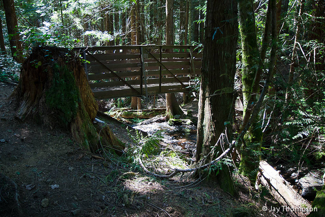
This closure was a result of multiple rescues being needed in 2018 from falls and injuries in the steep terrain. I talked with the owners of the Tree Farm last night and they said that they plan to open an official trail to these lower falls sometime over the winter. Access to Dickerson Creek Falls over the bridge is still open. PLEASE heed these signs and warnings and do not attempt to go down to the bottom of the canyon until an official trail is built.
The northeast side of the Blue Hills is drained by several creeks that join together to form Chico Creek, which flows into southwestern Dyes Inlet. One of these creeks is named Dickerson Creek. Dickerson Creek is mostly located on the Ueland Tree Farm, a publicly open area that is harvested for resources such as timber and rocks.
About a mile upstream of its confluence with Chico Creek, Dickerson Creek drops over a pair of waterfalls.
At the first falls, Dickerson Creek encounters a shelf of basaltic bedrock and dives 12 feet into a beautiful plunge pool tucked into a rock alcove. A massive nurse log spans the plunge pool, covered in ferns and huckleberries. At high flows, this waterfall can put out an impressive amount of mist and spray for its size. Due to its great beauty, I call this "Elegance Falls."
"Elegance falls" from the base. 2016. Photo by Micah K.
Following "Elegance Falls," Dickerson Creek flows around a bend and skips down a series of shallow cascades. While pretty, these cascades do not meet the height requirement to make it to my main list of falls.
About 60-80 feet downstream of "Elegance Falls" Dickerson Creek drops over another rock ledge. This fall, significantly larger than "Elegance;" is split completely in two by a large protruding wedge of rock. One half of the creek drops almost the entire 20 feet in a steep sliding cascade. The other side drops two-thirds of that distance in a series of steep cascades, before leaping over the final eight feet in a small horsetail. Because of its bisected appearance, I have suggested the name "Divergent Falls" for this waterfall.
"Divergent Falls" from a precarious viewpoint on the canyon wall. 2016. Photo by Jonas B.
After "Divergent Falls" the creek quiets down significantly. It meanders through the rest of the canyon calmly, only punctuated by a couple small three-foot cascades. From there, it flows into the lowlands where it eventually meets up with Chico Creek.
Gold Creek is a tributary of the Tuhuya River, which drains the large, fault-created valley between Gold and Green Mountains in the Blue Hills. The creek begins in a series of small connected lakes and ponds, many of which are formed in part due to the heavy activity of the local beavers, which have created dams in several places. After flowing quietly from these lakes, the creek begins its descent down towards Lake Tahuya.
Within a half-mile of exiting its source, the creek has carved a large canyon through the thick glacial deposits here and into the gabbro and andesite/dacite dikes of the Blue Hills. At the head of this canyon is a small but charming set of cascades roughly 25 feet high, crashing over a series of gabbro outcrops and an andesite dike in eight or so drops; this is "Gold Creek Cascades."
"Gold Creek Cascades" in high water
The cascades are relatively easy to access from the Gold Creek Trailhead. From the trailhead, simply follow the trail towards Gold Creek until it joins an old logging road. Walk along the road for about 10 minutes until you hear audibly rushing water to your left. At this point start looking for a side trail branching off and heading down towards the creek. This trail goes down the steep side of the canyon, dropping down until you come to the base of the cascades.
After the cascades, the creek continues its journey through the canyon towards the lake without encountering another set of cascades like the beginning. However, it does trip over several more outcrops of bedrock, creating some delightful chattering rapids and bouncing drops not more than four or five feet high. Following several of these whitewater features, the creek quiets and meanders peacefully through the forest before emptying into the lake.
Located in the heart of East Bremerton is a small park encompassing a steep-walled defile carved into the glacial deposits and clay layers near the Port Washington Narrows. This is Stephenson Canyon. flowing through this canyon is small but quaint Stephenson Creek, which flows year round. Looking at topographic maps and google terrain imagery. I entertained the idea that somewhere along this canyon there might be a waterfall. I wasn't expecting a titanic 50-60 footer producing a jet like roar, but I entertained the possibility of maybe a small one ten to twenty feet tall or a pretty cascade, and my curiosity drove me on.
Shaded relief map from Google Maps showing the location of Stephenson Canyon in East Bremerton.
One afternoon I drove down to the canyon, parked at the trailhead and began walking upstream along the creek. The gently rounded boulders and vegetated slopes soon gave way to hard blue clay shelves and carved notches. Once or twice I passed by some very tiny cascades maybe one to two feet high tumbling over more resistant clay outcrops. And soon the clay gave way completely to slippery bedrock, which suddenly rose out of the creek producing a delightful three-foot-tall cascade.
Three Foot Cascade. Photo by Micah Kipple
Pushing on around a couple more bends, the sound of hissing water made me look up, and there leaping off of a small ledge of rounded rock into a green-blue catch basin was a five-foot waterfall. A smile crossed my face as I stepped onto a nearby ledge on the creekside to get a better look. Then I saw the second tier. Almost hidden by a sharp turn in the creek, this tier slid down the shallow face of another basalt ledge another five to six feet, bringing this waterfall's total height to about 10 feet. I was ecstatic, while there were numerous signs I wasn't the first one here. I was still pleased I had found a waterfall, regardless of how small it was (Ok, if it was under four feet it would be pushing it), and smack in the middle of Bremerton no less.
The lower horsetail tier of Stephenson Canyon Falls. Photo by Micah Kipple
While these falls are beautiful, getting to them is somewhat of a chore, and they aren't as pretty as they could be. I'm going to make an effort to pick up trash while I'm there in the park, and I need to find a way to put this on the City of Bremerton's radar so maybe there can be an official volunteer effort to clear the area around the falls. That would be very nice indeed and would make this a destination to keep going back to.
A close up of the lower tier. Photo by Micah Kipple.