Tuesday, December 3, 2013

Beehive Geyser

Across the Firehole River from Old Faithful rises a barren white hill covered with gray minerals and bright streaks of bacteria. This is aptly named "Geyser Hill" and it contains one of the largest concentrations of geysers in the world. Several of the geysers are significant spouters, and one of them is truly spectacular when it plays, and is usually a crowd favorite.

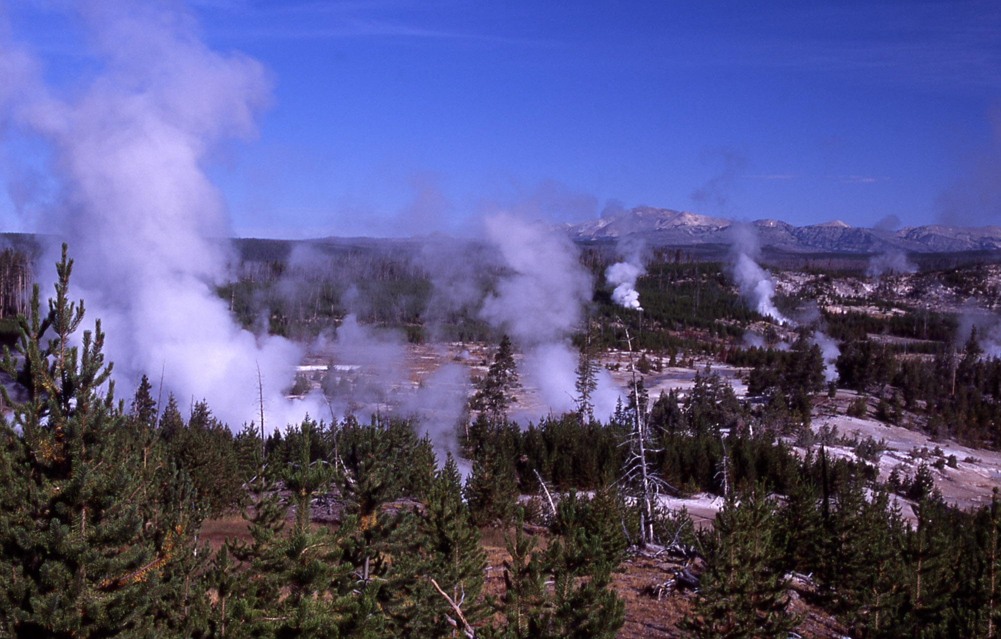
Geyser Hill in the early morning

Beehive Geyser lies on the southern edge of Geyser Hill. Its name is based on its four-foot-tall cone that rises out of the surrounding sinter platform, resembling an old fashioned straw beehive. Most visitors walk right past Beehive during its quiet interval, only giving off subtle subterranean rumbles, wisps of steam, and occasional splashes. But, once a day, something occurs that sends the observing Geyser Gazer scrambling for their radio, and has all the other Gazers speeding in from across the Basin. Beehive's Indicator erupts.

Beehive's Indicator erupts, Beehive is the cone on the left.

Beehive's indicator is a jagged vent a few feet in front of Beehive, between the boardwalk and the cone, that fills with water and erupts up to 15 feet. As hinted by its name, Beehive's indicator usually only erupts just before an eruption of Beehive.

Somewhere between seconds and 30 minutes of Beehive's Indicator starting, Beehive will suddenly pour out a surge of superheated water from its cone, dousing the surrounding area and sending up a ball of steam. This is followed by a huge jet will exploding from the cone, blasting into the air and climbing 150-200 feet into the sky. The spectacle is one of the best in Yellowstone. During many eruptions, visitors will be showered by the falling water of the eruption, getting soaked within seconds. This water is usually cool, as it has time to chill as it falls through the air after leaving the vent.

With the boardwalk coming within 50 feet of Beehive, the sound of the water is incredible, reminiscent of a roaring jet engine. Supposedly the sound is due to the steam and water escaping through the vent at nearly supersonic speeds, although this theory has yet to be proven.


Beehive erupting in June 2014. Photo by Micah K. 

When I arrived in Yellowstone at the beginning of summer in 2013, Beehive was cooperating fairly well. 16-20 hours were the norm, with the occasional curveball interval thrown in. Then, on July 4th, things took a surprising turn. Beehive's indicator decided to erupt for an hour. Beehive splashed, and splashed, and splashed, but did not erupt. Geyser Gazers and visitors who were expecting a show groaned, but for different reasons. For visitors, it was the fact that the Geyser hadn't erupted as "promised" by the Gazers. For the Gazers themselves, it was because a "false indicator" means that Beehive is probably "broken".

 Sure enough, Beehive was "broken" for the entirety of the rest of the summer. Indicator began a pattern that would continue for months, erupting for 45-60 minutes every 3-4 hours. Beehive sometimes went days between eruptions, and several of them occurred with no indicator preceding it. After July 4 I only got to witness four more Beehive eruptions, two of them from a distance, one of them in the middle of the night from a distance, and one, by sheer luck, from the boardwalk in front of it.

Regardless of how Beehive behaved that summer, it's always a thrill of looking up and seeing indicator jetting outward, and the roar of Beehive's column as it towers skyward is always awe-inspiring. And once again, it's a crowd-pleaser, and I always love it when visitors get to enjoy the wonders of Yellowstone's Geysers.

Beehive Geyser and its indicator at sunset. Photo by Micah K. 


Tuesday, November 26, 2013

Vixen Geyser

30 miles North of Old Faithful and the geyser basins along the Firehole River, past the Madison River and through the Gibbon Canyon lies a large unique thermal basin. This is the Norris Geyser Basin. Norris has long been known as the most energetic basin in terms of activity, but in recent years. Geyser Gazers have began to call Norris "Snorris" for it's lack of geyser activity. There are only 3-5 semi-reliable geysers here. And if your lucky, something else will erupt for you somewhere along the trail system.

Norris Location
 Norris Geyser Basin is divided into two main sections. The North end of the Basin is dubbed the Porcelain Basin. It is characterized by it's barren flat landscape, full of sizzling areas, roaring fumaroles, and numerous small perpetual spouters. Temporary features rather than permanent ones are the norm here generally, save for a select few hardy survivors, but that is a topic for another post.

The scenery of the Porcelain Basin. Photo courtesy NPS
 The South portion of the basin is called the Back, or Tantalous Basin of Norris. Here many of the features are more permanent, and back in the day this contained several significant geysers. Of course, this basin is home to the most significant geyser in the world. Steamboat Geyser, again, that's a whole different topic that will be discussed in detail later.
The scenery of the Back Basin Photo courtesy NPS

Presently there is only one geyser that is really well behaved in the Back Basin, and that term is used in the most cautious way. Because Vixen Geyser can really live up to its name.

Vixen Geyser erupts! Photo courtesy of MA Bellingham

Vixen Geyser is a fountain-type geyser, that erupts from a small reddish crater a stone's throw away from the boardwalk (of course, you wouldn't dare take that literally.). You never really know what your going to get with Vixen, it can have dormancies of several years, and then suddenly spring back with fantastic eruptions that make gazers elated.

This year I visited the Norris Geyser Basin 2 times (4 if you count when I went to watch the Steamboat eruption this year). The first time I spent just an afternoon there, where I saw 2-3 eruptions of Vixen. That first visit the eruptions were about 40-50 minutes apart, and lasted only 1-3 minutes. I visited Norris again in September, where I watched Vixen for probably a total of about 4-5 hours. To my utter joy, Vixen was going crazy. Eruptions were occurring every 25-40 minutes apart and lasting anywhere from 2-7 minutes, it was a blast. a couple of the eruptions threw nice sized rocks, and after every eruption the crater drained with a hilarious and delightful draining sound.


Me watching Vixen Geyser erupt with a group of visitors
Video courtesy of Natalie H.

I was surprised Vixen climbed so high on my favorite geyser list, but I can see why. For one, it's a small feature, and I have a soft spot for the small features. 2nd, it's close to the boardwalk, so you can easily observe it. 3rd, it is a visitor favorite, they love Vixen! especially the drain sound. And 4th, it has a pretty straight forward building of events to any eruption. Usually it starts with wisps of steam drifting out of the crater, almost unnoticeable, then gurgling is heard within the vent, and gets louder as the water level gets higher. Soon water starts to surge within the crater, boiling and frothing and causing a commotion. Finally at some point, there s a larger than normal surge that gives way to jets of water knifing into the air about 10-15 feet. It's a great little show for a small geyser, and that's why it's number 5 on my top 20 list.

Friday, November 8, 2013

Penta Geyser.

Nearly smack dab in the center of the Upper Geyser Basin, surrounded by an open sheet of sinter deposits, bordered on the south by the frigid (Ironically named) Firehole River, Lies a cluster of about 19 different springs and geysers in an area roughly the size of half a football field. Welcome to the Sawmill Group.
Aerial view of the Sawmill Group. Geysers are White, Hot Springs are blue, Penta Geyser is Gold. 

Named for the largest Geyser in the group, this is one of the most fascinating groups of features in Yellowstone. Why? because of a certain type of activity known as an "exchange of function". When you walk up to the Sawmill Group, you are walking up to a geothermal battlefield. every day there is a constant battle that rages for which geysers get the energy. I'll explain more of this activity of the whole group on a later date, but for now, I'm going to focus on the geyser that is cherished (and loathed) by many a geyser gazer in Yellowstone. This is the humble, yet mighty, Penta Geyser.

Penta Geyser's cone. taken from a kneeling position on the boardwalk. June 2013.
Photo courtesy of Micah Kipple 

Penta Geyser is one of the many geysers in Yellowstone that "thrives on the tears of geyser gazers", you need just the right kind of set up to get it, and sometimes even the set ups end with crushed spirits and vehement cursing. But when the set up actually ends in a eruption, it is a one of a kind show. Penta is named for it's 5 vents, the largest of which erupts to 25 feet. the other's can get up to 6 feet. Here's the catch, Penta is only about 4-5 feet from the boardwalk. Which means when there's an eruption. It's shower time. The pulsing jets of this delightful cone can last for 2 hours, this year however, it's been anywhere from 40 minutes-1.5 hours.

Penta Geyser erupts September 6, 2013. Photo courtesy of Suzanne Strasser. 


Penta Geyser eluded me for almost the entirety of the 3 months that I was employed in Yellowstone National Park in 2013. I always seemed to miss it, sometimes only by minutes. It erupted 25 times behind my back. Finally, on September 6, 2013, my luck held, and while waiting for nearby Grand Geyser (#10 on the list) Penta geyser was called. One gazer also waiting on a nearby bench simply recalls "a orange blur flying down the boardwalk blowing by bewildered tourists". But I managed to make it, and enjoyed almost the entire eruption of 52 minutes.

Celebrating my first Penta eruption. Photo courtesy of Suzanne Strasser

Wednesday, October 16, 2013

Morning Geyser-Lower Geyser Basin.

"MORNIIIIIIIIIIIIIIIIING!!!!" I pounded on the railing of the observation platform with my fists in excitement as a jet of golden superheated water knifed through the steam. Morning Geyser had finally erupted for me at 0647 on July 16, 2013.


After the post I wrote on the 25th of May, which can be read here, Morning Geyser continued its active phase through the month of June and into July, where it seemed to slow down slightly. However, Morning continued to erupt through August. And then in September it took part of an event known as a "Trifecta" in which Morning, Morning's Thief Geyser immediately next to it, and Fountain Geyser all erupt simultaneously. This event happened four times over the summer. However, as awesome as this event is to behold (Morning and Morning's Thief can erupt for an hour,  Fountain can erupt for 3 hours) it was begun to be seen as a bad omen, because each successive time there was a Trifecta, the next interval to Morning got longer. Many people blame the last Trifecta which occured on September 3 (which I was lucky enough to witness) for Morning's lapse back into dormancy.


Geyser "Trifecta" on September 3, 2013, Morning is illuminated by the huge spotlight, Morning's Thief can be seen just right of Morning, and Fountain is just off frame to the left. Photo courtesy of Pat S.

For some unfathomable reason for the first third of my summer in Yellowstone, I didn't make that much effort to try to see Morning, a mistake that cost me many potential eruptions I could've seen. I tried to convince myself that I was waiting for the right opportunity (I wanted fountain to have a 40+ minute duration eruption). Well, that unmistakable opportunity happened on the evening of July 15th, when Fountain had a 40 minute duration eruption. Unfortunately, that meant that in order to be there in time for the morning window (7-9 hours after Fountain) I had to be at the Lower Geyser Basin Fountain Paint Pot area by no later than 6.

Through a somewhat crazy train of events, I managed to arrive at the Fountain Paint Pots around 6 ish. 47 minutes later, I was rewarded as Morning erupted just as the golden sunlight streamed over the hills to the east. It was burst after burst, some were thin jets that shot straight up. Other times the entire pool domed up in a Blue Bubble that exploded with a *KA-WHUMP*. It was the geyser experience of a lifetime, the sheer power mixed with beauty that I witnessed is unparalleled than anything I have ever seen, and what I would give to experience it again.


Morning blue bubble during the July 16, 2013 eruption, Photo by Micah K
Alas, it could be up to over a decade before Morning decides to play again if this turns out to truly be a return to dormancy. But I consider myself lucky that I was at least able to see it twice in this active phase, and one thing's for sure, if it ever starts up again, I'll be going up to the Lower Basin every chance that there is for Morning.

Sunday, June 23, 2013

Geysers by Moonlight, night Gazing in Yellowstone.

I suppressed a shiver, gripped my pencil tighter, and tugged my hood further down over my face. Cold mountain wind knifed through me as I stared at the steaming pool before me, Depression was due, very due. Suddenly I caught movement, clicking on my headlamp I observed water pouring over the large sinter rim of the jagged crater.  Finally.

The first jet caught me by surprise, making me jump in my folding chair as it blasted through the pool. After that, my smile widened as Depression Geyser threw water up to ten feet, it was a strong eruption. Of course it had to be at night. 

It's been 2 weeks in Yellowstone, and of course, when I'm not at work, I'm out in the basin. However, many of my shifts have me getting off at 7-9:30 pm, the gazing takes place early morning and in the evening. But it has made me realize that night time gazing is different from gazing during the day time, your senses increase in sensitivity, the smallest splash makes your head swivel looking for a source. You play everything by ear. 

I almost enjoy night gazing more than I do day gazing because of how much more in depth it is. No distractions of crowds, or car horns, or radio transmissions. It boils (pun intended) completely down to your own observational skills and experience, there's no group of older gazers to tell you what to look for, your entering into a whole new playing field with the Geyser. It's just a chess game of time and observing patterns to figure out what it's going to do. And that's what Geyser Gazing is all about.

Watching the Sawmill Group under the stars Photo Courtsey of Will Boekel.

Saturday, June 8, 2013

Geologic Pit Stop: Dry Falls, Eastern Washington.


Earlier this week, while I was planning my  route to take to yellowstone, I decided to take a slight detour up to the north. Directly in the heart of eastern Washington lay a province known as the Channeled Scablands. This area is named for the massive canyons, or "Coulees" that pockmark the area. (Coulee? Sounds familiar, as if there's a large landmark in the state that has that word in its name, comment below if you know!) 


These Coulees are some of the most fascinating geological features in Washington State. Not just because of the Coulees themselves. (which are awesome!) But because of the massive geological event(s) that created them. 


15,000 years ago during the last major ice age, a massive ice sheet smothered the entirety of Canada and much of the present day northern United States in a sheet of ice that in some places was 5,000 feet thick.

Part of this large ice sheet, a lobe, desceded through the mountains of present day northern Idaho, and completely blocked a river valley with a wall at least 1,000 feet high. The River in the valley backed up. Eventually creating a massive Glacial Lake that covered an area more than Lake Superior and Lake Ontario combined, and submerged the present location of Missoula Montana under 1,000 feet of water. 


One day however. As the temperatures increased. The ice dam collapsed, and Glacial Lake Missoula poured through the opening, the almost incomprehensible torrent tearing right towards Eastern Washington. Once the massive flood reached the brittle Basalt Flats covering the area, the sheer power and force of the water dug deep channels into the bedrock, creating the coulees we see today. 

Dry falls is located in the biggest (aptly named Grand Coulee. It is where the floods created a huge waterfall, hundreds of times bigger than Navada Falls in New York.  And you can see where this waterfall was, ad what damage it did to the rock. Along highway 17 there is a visitor center perched right along the "brink" of the falls. It tells the geological and human history of the area, and also sells books and posters on the subject. 


I stayed at this visitor center for about 20 minutes before hopping back into Ol Bess' and continuing my journey. Very excited for what geological adventure ill have next!

Saturday, May 25, 2013

Morning Geyser, Reclusive sentinel of the Lower Geyser Basin

Last summer, there were several geyser events that occurred in Yellowstone National Park that had set the geyser gazing community abuzz with excitement. One of the most significant events was the reawakening of one of the most powerful geysers in the park; Morning Geyser. Located in the  Lower Geyser Basin, North of Old Faithful, Morning Geyser is a sight to see. It's eruptions are capable of being 200 feet tall and 100 feet wide, and when viewed on a clear sunny day, the pictures themselves are breathtaking. 

Morning Geyser, May 6, 2013. Photo Curtsey of Maureen M.

Morning erupted for the first time in 18 years on June 20, 2012. The news spread like wildfire, and soon gazers were arriving at the park in droves to try to get a glimpse of this possibly once-in-a-lifetime event. And on the bright sunny morning of June 21, 2012, More than a dozen gazers witnessed Morning rise and erupt in all of it's splendor at 10:40. 

 
Video by Tara Cross

 If you listen closely in the video and turn up the volume, just before the large bursts, you can hear a muffled "WHUMPH". The origin of this sound comes from a amazing phenomena that only happens in a handful of geysers around the world; the blue bubble. blue bubbles form when the entire conduit underneath the pool of the geyser is filled with steam, the pressure from the steam pushes the remaining water out all at once, but instead of spraying in all directions immediately, the surface tension of the water holds it together as a massive azure blue bubble for a split second, before it explodes and sends water bursting in all directions. 

Classic Blue Bubble at Strokkur Geyser in Iceland, Blue bubbles almost always occur at the onset of this geyser's eruptions. Photo curtsey of www.wjla.com via google images.

At Morning, there are numerous blue bubbles during it's eruptions, and although I have yet to see a picture of an intact blue bubble at Morning, there are some incredible photo's taken directly after one bursts. Such as below. Once again, this is the May 6th eruption. 

Photo Curtsey of Maureen M.

After it's initial eruptions on June 20 and 21, Morning continued to sporadically be active throughout the rest of the summer, although erupting days apart, making it extremely difficult to catch. I myself missed morning by about a day last year, but I'll be darned if I miss it again this summer. After the summer crowds and geyser enthusiasts trickled out of the park, Morning's activity remained relatively a mystery throughout the late fall and early winter. 

However, we did have two huge advantages. The first was the wonderful and gracious observations of tour guides running snow tours past Morning during the winter. They would look for tell-tale signs of Morning's activity for us; checking to see if runoff channels were free of snow (the warm water from the geyser would melt the snow filling the channels) and observing if Fountain Geyser (the much more frequent geyser that resides in the crater in front of Morning) was throwing out more rocks than usual or behaving differently (they are indirectly connected). The second advantage was the presence of an electronic data monitor at Fountain, which picked up many Fountain Geyser abnormally long duration eruptions. usually these eruptions mean that Morning erupted during the event, although it's not certain at all. But we now are at least near certain that Morning was active throughout the winter of 2012-13. 

Morning's runoff channel melted free of snow on 1/29/13. Photo curtsey of Yellowstone Tour Guides

 Finally, after several months of uncertainty Yellowstone Tour Guides photographed an eruption on March 8, and then there was even second eruption 5 hours later! Morning was alive! The anticipation was excruciating leading up to the park's official opening in late April. Finally the gates opened and a gazer that is well known for studying the group of geysers that Morning's a part of began to observe that area daily. Then, on May 3, 2013, she witnessed a spectacular event as Morning and Fountain Geysers erupted together for almost a half hour, an event which had only happened probably only once before in this current eruptive phase. 


After this awesome event, Morning erupted 2 days later on the 5th of May, and then yet again on the 6th. Since then there have been at least 5 events, you can see the latest activity of Morning here. As of this writing, Morning's last eruption was on the morning of May 25, 2013 at 0557 in the morning. There is speculation that Morning could be starting to begin a new extremely active period of activity similar to that of it's activity in 1994, where it erupted like clockwork almost every 3-6 hours. One can only hope!

I forgot to mention one thing. Morning's name. Morning is one of those geysers that hates wind, if there's a lot of wind, Morning (usually) won't erupt. At Morning's location, the wind intensifies most during the afternoon, so the majority of its eruptions take place during the Morning, hence the name!

Tuesday, May 21, 2013

May, Volcano Awareness Month

Last year, Governor Gregoire of Washington declared May to be "Volcano Awareness Month" in Washington State, a decision which, although relatively unknown, is a wise one. Washington hosts five major Volcanoes, 4 of which are well known. From North to South there are Mount Baker, Glacier Peak, Mount Rainier, Mount Saint Helens, and Mount Adams. Of these five, the most recognizable in the state and the most well known as a volcano, is of course, Mount Saint Helens.

The 18th of this month marked the 33rd anniversary of the most cataclysmic volcanic eruption in the United States, Mount Saint Helen's in 1980. 57 people died as a two month build up in activity culminated in a titanic eruption that razed 230 square miles of timber to the ground, sent massive lahars (mudflows) churning down the surrounding valleys, and dropped ash as far east as Oklahoma. Since then the volcano has been modestly quiet, with a smaller eruptive period from 2004-2008, but I don't have a shadow of a doubt in my mind that we will see Mount Saint Helens reawake again in our lifetimes, perhaps even more violently than May 18, 1980.
Mount Saint Helens erupts on May 18, 1980


But it is exceedingly important that we remember that Mount Saint Helens is not the only, or even the most dangerous volcano on our doorstep. 60 miles southeast of the Seattle-Tacoma metropolitan area, there is a sleeping giant almost 6,000 feet higher than it's southern fitful neighbor. Mount Rainier looms over the Puget Sound region, looking peaceful enough from that angle, with it's well rounded silhouette sitting backdrop to the Emerald City. But Mount Rainier is a decade volcano, considered to be the most dangerous in the United States. And it's not for reasons that many people think. Mount Rainier is a relatively gentle volcano in terms of volcanism itself. It does not produce (or at least, very rarely) the massive explosions and churning ashclouds of St. Helens. No, Mount Rainier's deadliest threat may not even need to be triggered by volcanic activity, but rather, it can simply give in to the relentless pull of gravity itself.

Mount Rainier has, can, and probably will produce massive avalanches, Some of which have swept across areas populated by some 200,000+ people and then into Puget Sound. These avalanches are the result of rock being weakened by acidic water circulating in the volcanic cone, and then simply losing their structure and collapsing. If one of these mudflow events happened today, the results would probably be catastrophic.

Aside from Mount Rainier and St. Helen's major threats to the region. There are three other volcanoes that still have the potential to create their own hazards. Baker, Glacier Peak, and Adams. I will not outline the hazards now, since that would take too much time. But this is where Volcano Awareness Month comes in. It is our job, as people living under the threat of these fire mountains, to teach ourselves how we can cope with and prepare for a volcanic eruption in our state. The more people are prepared, the faster we can get ourselves out of the danger zone and adequately protect ourselves in the event of a volcanic unrest.

I know you've heard it all before, Prepare, stock up food, get evacuation plans ready, but I urge you, this month, when you have a few minutes. Ask yourself, if you're travelling on I-5 and Mount Rainier erupts or suffers from a avalanche that turns into a mudflow, where do you go? If a sudden shift in prevailing winds carries the ash column from Mount Saint Helens over the sound area, what do you do to protect yourself from the fallout? If you happen to be in a river valley around a volcano, and activity begins, how do you escape? Think about these things, be prepared, because I believe adamantly that in our lifetime we will see some degree of volcanic activity again in our state. We just have to be ready.

Friday, April 26, 2013

Green Mountain, Kitsap County's "Glorified Hill"

I'll be honest, as a geology student, I'm probably one of the worst places in Washington State to be. With two mountain ranges, A basalt plateau, batholiths, and volcanoes, it's hard to escape significant geological forces in the Evergreen State. However, I seem to have done it, as my stomping grounds lie on the Kitsap Peninsula, a relatively flat strip of land covered in timber and Glacial Till sandwiched between two fjords. Near the beginning of the Holecene Epoch (10,000 years ago roughly) Kitsap Peninsula and the entire puget lowlands were covered with up to 3,000 feet of ice, a large lobe from the ice sheet that smothered what is now Canada. Looking at the peninsula from the air, the evidence from the ice sheet is still clear, with numerous Karns and glacial formations dotting it.

The Middle of Kitsap Peninsula with numerous Karns.
 Green Mountain is the lump directly to the West of Bremerton. 

However there is one prominent area where it seems the ice did not grind it completely down to dust. Smack dab in the middle of the Peninsula lies the highlands of Green and Gold Mountains. This is probably the most wild it's gonna get on the peninsula. Old Growth Forests with walls of Wild Rhododendrons, Large ponds backed up behind huge dams from wild Beavers. And the occasional Rocky outcrop where if one scrambles high enough, they can see the skyline of Seattle to the East, and the wall of the Olympics to the West.

Green and gold Mountains from a Hilltop overlooking Silverdale. 

For those in the Kitsap County not feeling up for the multiple hour drives to the Cascades or Olympics, the Green Mountain State Forest offers a charming alternative. A rare chance to experience wilderness less than an hour away from the hustle and bustle of the 75,000 person Bremerton area. Several trails of varying lengths and steepness wind up through the forests to the rocky Summit of Green Mountain, and the entire area is laced with old logging roads and boot paths that lead to mostly unexplored ravines, ponds, and hilltops. For a Geology student with a tight budget, it's a blessing to have right in my backyard.

Tuesday, April 2, 2013

A Summer Announcement

Hi all, it's been quite a while, I have been bogged down by schooling and preparations for this summer. Namely because I have just landed a job in Yellowstone National Park for the Summer as a Food Service Associate at the Upper General Store at Old Faithful Village! It's going to be an exciting opportunity, not only do I get to work at Yellowstone, but it means that this summer most of my free time will be used to watch and study the geysers I have come to become very fond of. And also, that means that this site will most definitely be updated as often as I can. Of course, I am unsure of how often that is, because I have heard rumors that the wi-fi is extremely slow and unreliable there, so I might have to find an outside gateway town to update in, but not to fear! I will do my best! So stay tuned! This site is really going to be churning out articles in a couple months!

Riverside Geyser, September 3, 2012

Monday, February 11, 2013

Movie Monday: Geyser Gazing Preseason Teaser

Hey everyone sorry there wasn't a Blast From the Past this Saturday, the post I was going to publish had some information that I was unsure if the USGS would appreciate it being put out in public. So I sent a email to my supervisor and advisor at CVO to ask if it was ok if I could publish it. Hopefully I'll get an email back this week. Anyways...It's Movie Monday!!!


Spring is just around the corner, and that means there's only a couple months left until the summer operating seasons begins in Yellowstone National Park. On April 19, the road from the West Entrance to all of the Geyser Basins open, and Geyser Gazing can begin. This video was put together by my fellow geyser gazer and good friend Will Boekel to celebrate geyser gazing and get us excited for what this season has to offer. Last season definitely was a blast (pun intended), and I'll be touching on that during my annual Thermal Thursdays. Until then, enjoy the video! My question is how many different geysers can you name? Comment below! No cheating!

Thursday, February 7, 2013

Thermal Thursday: Winter Steam Clouds

Winter in Yellowstone is probably one of the more drastic changes in a couple months that you can see anywhere on this continent. The wildflowers whither, the temperature plummets, and suddenly the ground is covered in a couple inches to several feet of snow for several months. Everything in the Park slows down almost to a crawl, that is, except for the Geysers.

Old Faithful erupting in Winter
In the winter, it seems that the only change that occurs to the geysers is that now even the smallest sput (a nickname Gazers have given to the little guys) can be seen, their steam columns become about ten times bigger, and it looks like a bomb has gone off whenever one erupts on the Old Faithful Streaming Camera.

Due to the increased visibility of the steam and from colder temperatures, Geysers begin to show visible steam "streamers" that are attached to every single drop that sputters out of them. At some points, the temperature becomes so cold that the streamers can be seen from the Webcam at Old Faithful. 
Sawmill Geyser erupting with streamers going nearly straight up.
Photo courtesy of Graham Meech
Despite the seemingly unchanged nature of the geysers during the winter, there is one geyser however, that is of considerable interest. Aurum Geyser, it is a small cone type geyser that erupts to about 30 feet for a minute and a half. During the summer it is a constant frustration of Geyser Gazers because of it's very erratic behavior, erupting 4 hours apart one time, and then taking a 48 hour break the next. Then something interesting happens. As summer gives way to winter. Aurum becomes practically predictable. it's eruptions about 4 hours apart. This winter, it was 4 hours 8 minutes +/- 12 minutes.

Aurum Erupting in the Summer

It is thought that the reason that this behavior occurs is because Aurum Geyser may be the only geyser in Yellowstone National Park that is affected by short term whether changes. If you want to accurately judge how frequent Aurum is, take a quick look at the grassy meadow behind it. If the meadow is wet and somewhat marshy, Aurum will probably be a bit more frequent. If the Meadow is dry. Then Aurum is probably reverting back to it's nickname graciously bestowed upon it by gazers over the years , "$&#@$&! Geyser". So with that theory it makes sense that Aurum is more common in the winter, the heat in the ground constantly melts the snow that falls on it, soaking that meadow for most of the Winter. In the summer there is little precipitation to wet the meadow, which means that Aurum is all over the place.  However, if there is a spell of rain or a thunderstorm in the park, Aurum will usually become more regular for a couple eruptions. but then it will become more erratic again. 

Aurum Steam trails this January. Photo Courtesy of  Graham Meech


In terms of Geyser Gazing, Winter is a challenging season. The Geysers keep going full steam ahead but there aren't people there to watch and observe them 24/7 like in the summer. The biggest reason for this is that time is limited in the Geyser Basins during the winter, since the only access to the Basins is via a special National Park "Snowcoach" and the tours are timed, so you can't just take your time and sit several hours at a geyser, you have to keep moving. You can get into the park for a day snowcoach or snomobile tour for relatively cheap. But for those who want an extended stay, such as the Gazers, it's a harder nut to crack because you would have to either rent a room at the Old Faithful Snow Lodge or rent a cabin.


On of the numerous Snowcoaches that deliver Visitors to different destinations around the park during winter
Photo Courtesy of Graham Meech
The second reason that Winter is a challenge for gazers is simply because it's hard to get around because of the thick snowpack and it's hard to stay in one place for a long period of time because of the sometimes below freezing temperatures. These difficulties are further worsened by fact that the spray from the geysers often freezes instantaneously wherever it lands, if this happens to be a boardwalk. Watch out!

Winter in Yellowstone, one of the more unique seasonal changes on the continent. Who's up for some snowy Geyser Gazing? 


Monday, February 4, 2013

Movie Monday: Taking a Volcano's Pulse


One thing that you'll learn about me pretty quickly is that I really enjoy making videos using the Macintosh program iMovie. I started doing it the same year that I entered tenth grade, and I've been doing it ever since. I made this movie partially as a summery and as a celebration of my week long field work expedition at Newberry Volcano in Oregon, it's slightly rough because I was still learning how to work with iMovie, but I am satisfied with the final product. Enjoy! 

See my other videos on my youtube channel. 

Saturday, February 2, 2013

Blast from the Past. Vol 1. Newberry Volcano Series: Geologic Background

From August 14-20, 2011, I became a Volcanologist for a week.

Through an amazing set of circumstances and events, I managed to become a part of a team from the Cascades Volcano Observatory that had the task of rigging a volcano up with monitoring equipment that it was sorely lacking. This is a series of blog posts that will break the different aspects of the trip up. 

A Geologic Background

The volcano in question was the Newberry Shield Volcano, an 800,000 year old 8,000 foot behemoth covering an area the size of Rhode Island and dominating the landscape of Eastern Oregon for miles around. At the top of this huge mound of volcanic rock is a caldera six miles across containing two lakes. Paulina Lake and East Lake,. There are also hot spring seeps along the lake shore that are cool enough to bath in.

Newberry is a unique volcano geologically due to the fact that it erupts both Rhyolite and Basaltic Andesite, in english that basically means the volcano erupts both very thick, sticky, explosive lava, like Mount Saint Helens. but it also erupts very runny and fast moving lava, like Hawaii. The more explosive, or viscous eruptions occur around or in the caldera, the last explosive eruption happening about 1,200 years ago. The more fluid lava erupts from huge fissures or cracks on the mountain's flanks and covers vast areas. The last time an eruption of fluid basaltic lava occurred was about 7,000 years ago. 
Newberry's Profile

The most concerning threat that Newberry presents is its large explosive eruptions thdat can blast ash high into the stratosphere and cover a vast area in a layer of volcanic ash. Newberry lies directly along the major air corridor spanning from British Columbia to California. This creates a huge danger for aircraft, when ash gets sucked into their engines, it shreds the circuitry and fries the electronics in the engines, as well as destroying the mechanical parts. When a 747 unknowingly flew into an ash cloud from a erupting volcano in Alaska in 1989, it almost ended in disaster. 

View of the Newberry Caldera, site of the volcano's more explosive eruptions.


Our team was a potpourri of people. There were seismologists, electricians, geochemists, geophysicists, grad students, a couple of volunteers. And then there was me, the youngest of the group, a lowly high school student along for the ride. 


We had 12 days to begin taking the volcano's pulse. Could we do it?